Near Spotsylvania Courthouse in Spotsylvania County, Virginia — The American South (Mid-Atlantic)
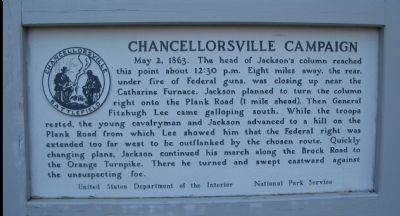
Chancellorsville Campaign
Erected by United States Department of the Interior - National Park Service.
Topics. This historical marker is listed in this topic list: War, US Civil. A significant historical date for this entry is May 2, 1966.
Location. 38° 17.292′ N, 77° 41.822′ W. Marker is near Spotsylvania Courthouse, Virginia, in Spotsylvania County. Marker is at the intersection of Jackson Trail West and Brock Road (County Route 613), on the left when traveling north on Jackson Trail West. Located on the Jackson Flank March driving loop in the Chancellorsville Battlefield section of the Fredericksburg and Spotsylvania National Battlefield Park. Touch for map. Marker is at or near this postal address: 10519 Brock Rd, Spotsylvania VA 22553, United States of America. Touch for directions.
Other nearby markers. At least 8 other markers are within 2 miles of this marker, measured as the crow flies. A different marker also named Chancellorsville Campaign (approx. 0.3 miles away); The Vermont Brigade (approx. 1.1 miles away); Echoes Homeward (approx. 1.1 miles away); Hell Itself (approx. 1.1 miles away); The Climax (approx. 1.1 miles away); Valuable Crossroads (approx. 1.1 miles away); No Turning Back (approx. 1.1 miles away); On to Richmond! (approx. 1.1 miles away). Touch for a list and map of all markers in Spotsylvania Courthouse.
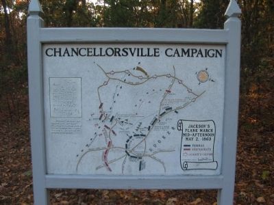
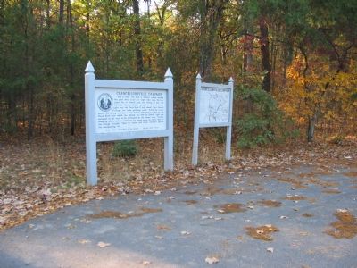
More about this marker. Next to the marker is a map showing the route of the flank march and Jackson's flank attack on the Federal positions.
Regarding Chancellorsville Campaign. This is one of several markers for the Battle of Chancellorsville along the Jackson's Flank March and Attack trail. See the Jackson's Flank March and Attack Virtual Tour by Markers in the links section for a listing of related markers on the tour.
Related markers. Click here for a list of markers that are related to this marker. Virtual Tour by Markers of the Jackson Flank March and Attack.
Also see . . .

Photographed By Craig Swain, November 10, 2007
2. March Map
Double click on the photo to see the details of the map. On the left of the marker is a facsimile of "Stonewall" Jackson's last dispatch in his own hand. According to tradition Jackson did not dismount but scrawled this note to Lee against the pommel of his saddle.
1. Battle of Chancellorsville. National Park Service site. (Submitted on December 2, 2007, by Craig Swain of Leesburg, Virginia.)
2. Jackson's Flank March and Attack Virtual Tour by Markers. This virtual tour covers the optional Jackson Flank Trail route of the driving tour and concludes at Jackson's Flank Attack (stop 8) of the driving tour, tracing the route of Jackson's march to deliver the decisive attack of the battle. (Submitted on December 8, 2007, by Craig Swain of Leesburg, Virginia.)
Credits. This page was last revised on July 9, 2021. It was originally submitted on December 2, 2007, by Craig Swain of Leesburg, Virginia. This page has been viewed 1,350 times since then and 50 times this year. Photos: 1, 2, 3. submitted on December 2, 2007, by Craig Swain of Leesburg, Virginia.

