Magnolia in Kent County, Delaware — The American Northeast (Mid-Atlantic)
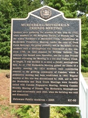
Murderkill / Motherkiln Friends Meeting
Erected 2005 by Delaware Public Archives. (Marker Number KC-90.)
Topics and series. This historical marker is listed in these topic lists: Cemeteries & Burial Sites • Churches & Religion • Colonial Era. In addition, it is included in the Delaware Public Archives, and the Quakerism series lists. A significant historical year for this entry is 1712.
Location. 39° 4.547′ N, 75° 28.754′ W. Marker is in Magnolia, Delaware, in Kent County. Marker is on South State Street close to Quaker Hill Road. Located just north of Magnolia along South State Street. Touch for map. Marker is at or near this postal address: 16 Quaker Hill Rd, Magnolia DE 19962, United States of America. Touch for directions.
Other nearby markers. At least 8 other markers are within 3 miles of this marker, measured as the crow flies. Warner Mifflin (here, next to this marker); The St. Jones River: Why the Mansion Faces South (approx. 2.4 miles away); Home of John Dickinson (approx. 2˝ miles away); St. Jones Neck (approx. 2.7 miles away); U-3A (approx. 3.1 miles away); C-60 (approx. 3.1 miles away); AN/GPN-20 Airport Surveillance Radar (approx. 3.1 miles away); C-45G (approx. 3.1 miles away).
More about this marker. Is located directly next to the historical marker for Warner Mifflin

Photographed By Nate Davidson, September 22, 2007
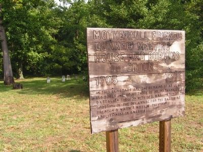
2. Motherkill Friends (Quaker) Meeting House and Burial Ground - 1705-1844
This makeshift marker is located at the same site. It reads: In this cemetary are the remains of at least 150 souls including those of Dr. Nathaniel Luff, battalion surgeon with Geo. Washington at the crossing of the Delaware for the Battle at Trenton & Warner Mifflin the first abolitionist in America.
Within the cemetery Dr. Nathaniel Luff's gravestone is extant, but Warner Mifflin's is not.

Photographed By Nate Davidson, September 22, 2007
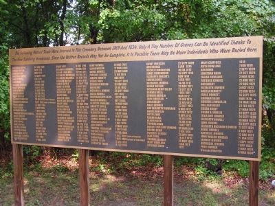
3. List of burials at the Motherkill Friends Meeting Cemetery
This marker, also on site lists the nearly 150 persons buried within the cemetery. The heading reads: "The following named souls were interred in this cemetery between 1769 and 1834. Only a tiny number of graves can be identified thanks to the few surviving headstones. Since the written records may not be complete, it is possible there may be more individuals who were buried here."
Credits. This page was last revised on March 7, 2023. It was originally submitted on January 4, 2011, by Nathan Davidson of Salisbury, Maryland. This page has been viewed 1,208 times since then and 54 times this year. Photos: 1, 2, 3. submitted on January 4, 2011, by Nathan Davidson of Salisbury, Maryland. • Bill Pfingsten was the editor who published this page.
