Thomas in Tucker County, West Virginia — The American South (Appalachia)
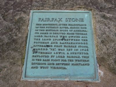
Fairfax Stone
Erected 1957.
Topics. This historical marker is listed in these topic lists: Colonial Era • Landmarks • Natural Features • Political Subdivisions. A significant historical year for this entry is 1746.
Location. 39° 11.67′ N, 79° 29.23′ W. Marker is in Thomas, West Virginia, in Tucker County. Marker is at the intersection of Fairfax Road (West Virginia Route 9) and Seneca Trail (U.S. 219), on the right when traveling west on Fairfax Road. Marker is located in Fairfax Stone State Park at the end of Fairfax Road. WV Route 9 is also called Kempton Road and Leadmine Mountain Road between US 219 and Fairfax Stone State Park. Touch for map. Marker is in this post office area: Thomas WV 26292, United States of America. Touch for directions.
Other nearby markers. At least 8 other markers are within 4 miles of this marker, measured as the crow flies. A different marker also named Fairfax Stone (approx. 1.7 miles away); a different marker also named Fairfax Stone (approx. 1.7 miles away); Hoye - Crest (approx. 3 miles away in Maryland); The Blackwater (approx. 3 miles away); A Window to the Past (approx. 3 miles away); A "Howling Wilderness" (approx. 3.1 miles away); Out On The Town (approx. 3.1 miles away); Connecting Thomas to the World (approx. 3.1 miles away). Touch for a list and map of all markers in Thomas.
Regarding Fairfax Stone. Although the Fairfax Stone marks the base point for the western dividing line between Maryland and West Virginia, the stone is actually located fully in West Virginia, about one mile due south of the extreme southwest corner of Garrett County, Maryland. In 1910 the Supreme Court ruled that the boundary of Maryland would only go west up the Potomac far enough to meet a point where a North line from the Fairfax stone would cross the branch of the Potomac used for the southern boundary of Garrett County.
The Fairfax Stone is also used today to mark the corners of Tucker, Preston, and Grant counties in West Virginia.
Also see . . . Wikipedia entry for the Fairfax Stone
. (Submitted on December 3, 2007, by F. Robby of Baltimore, Maryland.)

Photographed By F. Robby, August 18, 2007
3. Fairfax Stones
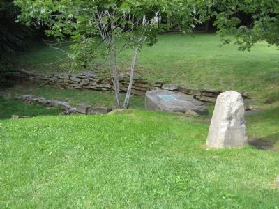
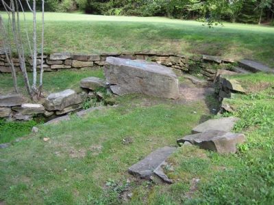
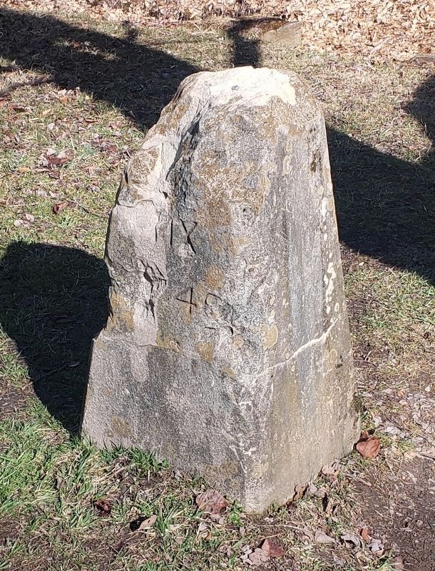
The marker plaque is attached to a natural stone overhanging the headspring. Nearby is a concrete marker erected in 1910 to replace the original Fairfax Stone which was vandalized in 1880. The 1910 marker is inscribed with a barely readable "FX-1746" on the south side and "1910" on the north side.
Credits. This page was last revised on March 29, 2021. It was originally submitted on December 2, 2007, by F. Robby of Baltimore, Maryland. This page has been viewed 2,517 times since then and 82 times this year. Photos: 1, 2, 3. submitted on December 2, 2007, by F. Robby of Baltimore, Maryland. 4. submitted on March 27, 2021, by Bradley Owen of Morgantown, West Virginia.


