
Grand Canyon National Park in Coconino County, Arizona — The American Mountains (Southwest)
Mining on Horseshoe Mesa
Photographed by James Hulse, June 21, 2024
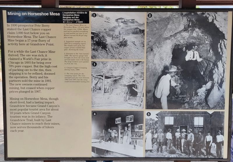
1. Mining on Horseshoe Mesa Marker
In 1890 prospector Pete Berry staked the Last Chance copper claim 3,000 feet below you on Horseshoe Mesa. The Last Chance Mine began a 17-year flurry of activity here at Grandview Point.
For a while the Last Chance Mine thrived. The ore was rich; it claimed a World's Fair prize in Chicago in 1893 for being over 70% pure copper. But the high cost of packing ore to the rim, then shipping it to be refined, doomed the operation. Berry and his partners sold the mine in 1901. The new owners continued mining, but ceased when copper prices plunged in 1907.
Mining on Horseshoe Mesa, though short-lived , had a lasting impact. Grandview became Grand Canyon's most popular tourist area for about 10 years when Grand Canyon tourism was in its infancy. The Grandview Trail, built by Last Chance miners to reach their mines, now serves thousands of hikers each year.
Erected by National Park Service.
Topics. This historical marker is listed in these topic lists: Environment • Exploration • Industry & Commerce. A significant historical year for this entry is 1890.
Location. 35° 59.927′ N, 111° 59.253′ W. Marker is in Grand Canyon
this page online

Regionally, this marker is in Flagstaff & High Country and in Hopi. It is also in the American Southwest, in the Mountain West, in Colorado Plateau, and at the Four Corners. Globally, it is in North America, the Western Hemisphere, the Western World, and the Anglosphere. Historically, it finds itself in what was once New Spain and also Mexico’s Alta California.
Other nearby markers. At least 8 other markers are within 8 miles of this marker, measured as the crow flies: Grandview, 1898 (here, next to this marker); Last Chance Mine (a few steps from this marker); Canyon on Canvas (approx. 3.6 miles away); Spanish Discovery (approx. 3.6 miles away); Tusayan Museum and Ruin (approx. 6.9 miles away); Tusayan Ruin Trail (approx. 6.9 miles away); Hance Rapid (approx. 7.9 miles away); Delta Farmers
Photographed by William Fischer, Jr., November 11, 2010
2. Mining on Horseshoe Mesa Marker
Also see . . .
1. Pete Berry. Destination4x4 website entry (Submitted on October 29, 2025, by Larry Gertner of New York, New York.)
2. Day Hiking the Grandview Trail. National Park Serice website entry (Submitted on January 11, 2011, by William Fischer, Jr. of Reynoldsburg, Ohio.)
3. Desert View Drive. National Park Service website entry (Submitted on January 11, 2011, by William Fischer, Jr. of Reynoldsburg, Ohio.)
Photographed by William Fischer, Jr., November 11, 2010
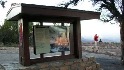
3. Mining on Horseshoe Mesa Marker
circa 1890's
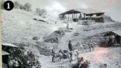
4. Photo on Mining on Horseshoe Mesa Marker
[Caption reads] The Last Chance Mine on Horseshoe Mesa, 1/2 mile below the canyon rim, 1890s. Mules and burros packed everything in and packed out tons of ore. Miners earned $4.00 per day plus meals.
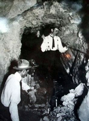
1907
5. Photo on Mining on Horseshoe Mesa Marker
[Caption reads] Inspectors sample ore in 1907 for a company report. The results were good, but copper prices crashed that year, dooming the mine.
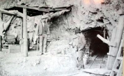
1906
6. Photo on Mining on Horseshoe Mesa Marker
[Caption reads] Entrance to the "new tunnel," 1906. The narrow gauge rails brought ore from the mine and carried waste rock to the dump. The large timbers were packed in from the rim.
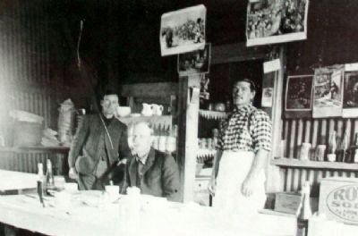
1906
7. Photo on Mining on Horseshoe Mesa Marker
[Caption reads] Canyon Copper Company dining room, 1906
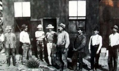
8. Photo on Mining on Horseshoe Mesa Marker
[Caption reads] The crew poses for the company report. The crew averaged just five men between 1902 and 1907, but the camp could accommodate twenty-five.
Credits. This page was last revised on October 29, 2025. It was originally submitted on January 11, 2011, by William Fischer, Jr. of Reynoldsburg, Ohio. This page has been viewed 1,621 times since then and 40 times this year. Photos: 1. submitted on July 7, 2024, by James Hulse of Medina, Texas. 2, 3, 4, 5, 6, 7, 8. submitted on January 11, 2011, by William Fischer, Jr. of Reynoldsburg, Ohio.
