Near Vermillion in Clay County, South Dakota — The American Midwest (Upper Plains)
Lewis and Clark Were Here...and Here...
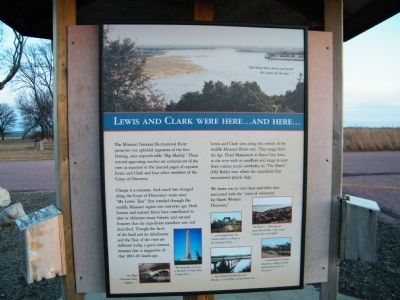
Change is a constant. And much has changed along the Corps of Discovery's route since "Mr. Lewis' Tour" first traveled through the middle Missouri region two centuries ago. Both human and natural forces have contributed to alter or obliterate many historic and natural features that the expedition members saw and described. Though the faces of the land and its inhabitants and the flow of the river are different today, a good amount remains that is suggestive of that 1804-06 landscape.
Lewis and Clark sites along this stretch of the middle Missouri River vary. They range from the Sgt. Floyd Monument in Sioux City, Iowa, to the river and its sandbars and snags as seen from various scenic overlooks, to "The Tower" (Old Baldy) near where the expedition first encountered prairie dogs.
We invite you to visit these and other sites associated with the "corps of volunteers for North Western Discovery."
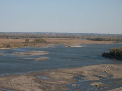
PICTURE CAPTIONS (top photo then from left to right): 1) "The Wind blew hard and raised the Sands off the bar..."
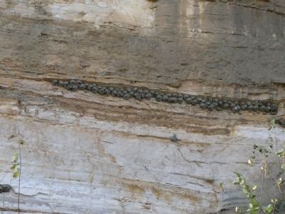
2) "this Bluff Contained Alum, Cooperas,..."
3) "We buried him on the top of the bluff 1/2 Miles below a Small river..."
4) "...and Camped below the Calumet Bluff in a Plain on the L{arbord} S{ide}..."
5) "...they informed me that they were Shooting...at an old Keg..we had thrown out..."
6) "this River is...Throwing out Sands like the Platt, (only Corser) forming bars in its mouth."
7) "...in descending this Cupola discovered a Village of Small animals that burrow in the grown..."
Topics and series. This historical marker is listed in these topic lists: Exploration • Waterways & Vessels. In addition, it is included in the Lewis & Clark Expedition series list.
Location. 42° 52.052′ N, 96° 57.362′ W. Marker is near Vermillion, South Dakota, in Clay County. Marker is on State Highway 19, 0.1 miles north of 312th Street, on the left when traveling north. The sign is one of several at a small asphalt pull-off loop road with a sign stating "Welcome to Spirit Mound Historic Prairie". Touch for map. Marker is in this post office area: Vermillion SD 57069, United States of America. Touch for directions.
Other nearby markers. At least 8 other markers are within walking distance of this marker. Lewis and Clark Visit Spirit Mound (here, next to this marker); Spirit Mound (a few steps from this marker); From Lewis and Clark to the Future (a few steps from
this marker); Hill of Little Spirits (about 500 feet away, measured in a direct line); Spirit Mound Monument (about 600 feet away); Daughters of the American Revolution Spirit Mound Monument (about 600 feet away); Canotina Paha | Mountain of Little People (about 800 feet away); Hill of Chalk (approx. 0.3 miles away). Touch for a list and map of all markers in Vermillion.
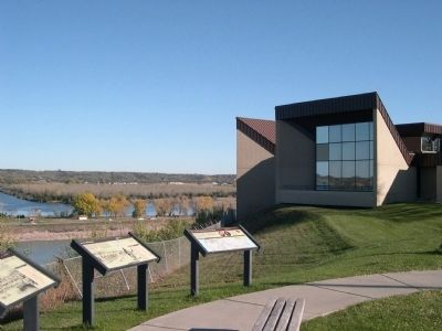
More about this marker. This is one side of a 3-sided informational sign at the park.
Credits. This page was last revised on March 30, 2022. It was originally submitted on January 14, 2011, by Rich Pfingsten of Forest Hill, Maryland. This page has been viewed 969 times since then and 20 times this year. Last updated on March 30, 2022, by Connor Olson of Kewaskum, Wisconsin. Photos: 1, 2, 3, 4. submitted on January 14, 2011, by Rich Pfingsten of Forest Hill, Maryland. • J. Makali Bruton was the editor who published this page.


