Marker Logo HMdb.org THE HISTORICAL
MARKER DATABASE
“Bite-Size Bits of Local, National, and Global History”
Army Navy Country Club in Arlington in Arlington County, Virginia — The American South (Mid-Atlantic)
 

Fort Richardson

Historical Site

— Defenses of Washington 1861 - 1865 —


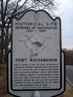
Fort Richardson Marker image. Click for full size.
January 15, 2011
1. Fort Richardson Marker
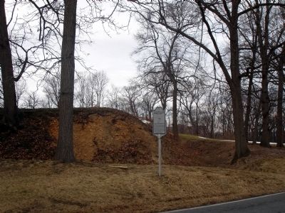
Inscription. Here is what is left of Fort Richardson, a detached redoubt constructed in September, 1861, to cover the left flank of the newly built Arlington defense line, It was named for General Israel B. Richardson, whose division was then deployed to defend against attack by way of Columbia Turnpike. It had a perimeter of 316 yards and emplacements for 15 guns.
 
Erected 1965 by Arlington County, Virginia. (Marker Number 16.)
 
Topics and series. This historical marker is listed in these topic lists: Forts and CastlesWar, US Civil. In addition, it is included in the Defenses of Washington series list. A significant historical month for this entry is September 1861.
 
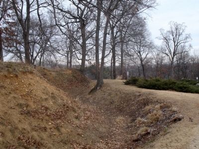
Location. 38° 51.464′ N, 77° 4.67′ W. Marker is in Arlington, Virginia, in Arlington County. It is in Army Navy Country Club. Marker can be reached from 18th Street South. The marker is located along the private Army Navy Country Club Access road alongside the remnants of Fort Richardson's parapets and ditches. Touch for map. Marker is at or near this postal address: 2400 18th Street South, Arlington VA 22204, United States of America. Touch for directions.
 
Other nearby markers. At least 8 other markers are within walking distance of this marker. Selina Gray (approx. 0.4 miles away); History of Bocce Ball (approx. 0.4 miles away); George Washington Carver Cooperative Apartments (approx. 0.4
Paid Advertisement
Click on the ad for more information.
Please report objectionable advertising to the Editor.
Click or scan to see
this page online
miles away); Albert I. Cassell (approx. 0.4 miles away); Arlington Village (approx. 0.4 miles away); St. John's Baptist Church (approx. half a mile away); Harry W. Gray House (approx. half a mile away); Hume School (approx. half a mile away). Touch for a list and map of all markers in Arlington.
 
More about this marker. In the center of the marker is a map of the Washington Defenses, with a red (weathered) arrow pointing out the location of Fort Richardson.
 
Fort Richardson Marker image. Click for full size.
January 15, 2011
2. Fort Richardson Marker
Fort Richardson Marker image. Click for full size.
January 15, 2011
3. Fort Richardson Marker
Looking east along the south wall and ditch.
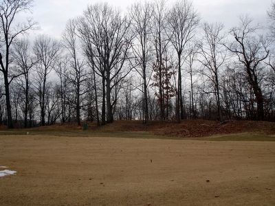
Fort Richardson Parapets image. Click for full size.
January 15, 2011
4. Fort Richardson Parapets
Looking south in the middle of the ninth green at the Army Navy Country Club golf course.
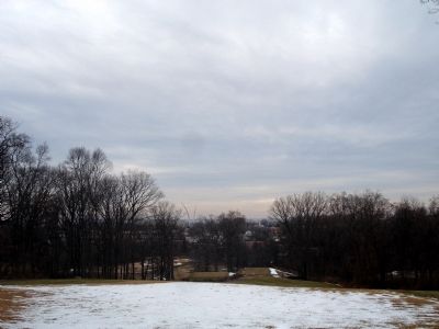
View to the northeast to Washington, DC image. Click for full size.
January 15, 2011
5. View to the northeast to Washington, DC
United States Air Force Memorial spires in center of photo.
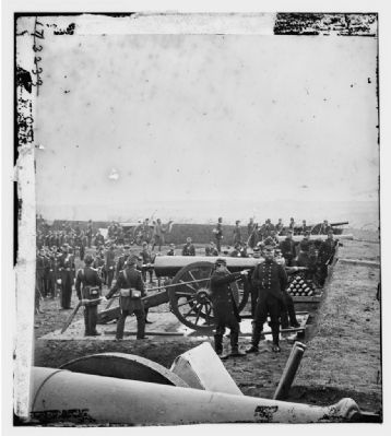
“Guns and gun-crews of Fort Richardson” image. Click for full size.
6. “Guns and gun-crews of Fort Richardson”
Photograph of 1st Connecticut Artillery drilling at Fort Richardson. Civil War photographs, 1861-1865 / compiled by Hirst D. Milhollen and Donald H. Mugridge, Washington, D.C. : Library of Congress, 1977. No. 0759
 
 
Credits. This page was last revised on March 3, 2023. It was originally submitted on January 15, 2011. This page has been viewed 1,981 times since then and 67 times this year. Photos:   1, 2, 3, 4, 5, 6. submitted on January 15, 2011. • Craig Swain was the editor who published this page.
Share this page.  
Share on Tumblr
m=39726

CeraNet Cloud Computing sponsors the Historical Marker Database.
This website earns income from purchases you make after using our links to Amazon.com. We appreciate your support.
Paid Advertisement
Apr. 16, 2024