Church Creek in Dorchester County, Maryland — The American Northeast (Mid-Atlantic)
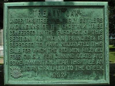
Treaty Oak
Erected 1932 by Daughters of the American Revolution.
Topics and series. This historical marker is listed in these topic lists: Colonial Era • Native Americans. In addition, it is included in the Daughters of the American Revolution series list.
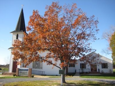
Location. 38° 30.282′ N, 76° 9.002′ W. Marker is in Church Creek, Maryland, in Dorchester County. Marker is on Taylors Island Road (Maryland Route 16) 0.2 miles east of Church Creek-Golden Hill Road (Maryland Route 331), on the right when traveling west. Marker is in front of the White Haven United Methodist Church. Touch for map. Marker is in this post office area: Church Creek MD 21622, United States of America. Touch for directions.
Other nearby markers. At least 8 other markers are within 4 miles of this marker, measured as the crow flies. Church Creek (about 700 feet away, measured in a direct line); Finding Freedom (approx. ¼ mile away); Walk the Old Trinity Heritage Trail (approx. 0.9 miles away); Writer, War Strategist, Enigma (approx. 0.9 miles away); Trinity P.E. Church (approx. 0.9 miles away); Malone's Church (approx. 3.7 miles away); Stanley Institute (approx. 3.8 miles away); a different marker also named "Stanley Institute" (approx. 3.8 miles away). Touch for a list and map of all markers in Church Creek.
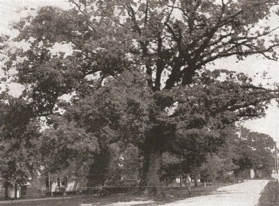
Regarding Treaty Oak. From Colby Rucker's report on Great Eastern Trees, Past and Present (http://www.nativetreesociety.org/ bigtree/great_eastern_trees.htm): Treaty Oak. White oak. Reputed to be nearly 400 years old, site of Indian treaty. Near state road, Church Creek, Dorchester County. Died 1957. ref.: Besley, Fred W. 1956. Big Tree Champions of Maryland. pp. 51, 53 (photo).
Credits. This page was last revised on June 16, 2016. It was originally submitted on December 4, 2007, by F. Robby of Baltimore, Maryland. This page has been viewed 2,703 times since then and 968 times this year. Photos: 1. submitted on June 5, 2011, by Allen C. Browne of Silver Spring, Maryland. 2. submitted on December 5, 2007, by F. Robby of Baltimore, Maryland. 3. submitted on December 4, 2007, by F. Robby of Baltimore, Maryland.


