Near Leedey in Dewey County, Oklahoma — The American South (West South Central)
California Road
First Crossed Here 1849
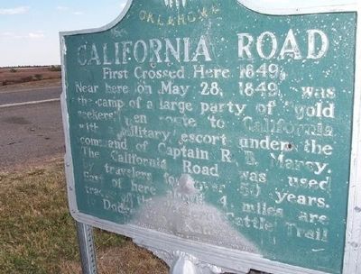
1. California Road Marker
Erected by Oklahoma Historical Society and State Highway Commission.
Topics and series. This historical marker is listed in this topic list: Roads & Vehicles. In addition, it is included in the California Trail, and the Oklahoma Historical Society series lists. A significant historical month for this entry is May 1974.
Location. 35° 53.818′ N, 99° 20.217′ W. Marker is near Leedey, Oklahoma, in Dewey County. It is on State Highway 34 - half a mile north of Road N2050, on the right when traveling south. Touch for map. Marker is in this post office area: Leedey OK 73654, United States of America. Touch for directions.

Regionally, this marker is in Northwest Oklahoma — Red Carpet Country. It is also in the American South, specifically on the prairies, and on the Southern Plains. Globally, it is in North America,
this page online
Also see . . .
1. The California Road. A listing of Oklahoma State Historic Markers with additional information on the California Road and Captain R.B. Marcy (Submitted on January 20, 2011.)
2. Captain Marcy and the California Trail. (Submitted on January 20, 2011.)
3. Biography of Captain R. B. Marcy. (Submitted on January 20, 2011.)
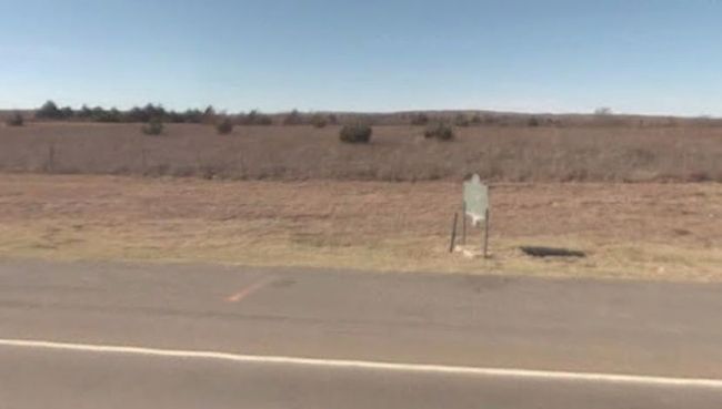
2. California Road Marker
Credits. This page was last revised on December 31, 2024. It was originally submitted on January 19, 2011, by Christopher Suttle of Norman, Oklahoma. This page has been viewed 1,791 times since then and 59 times this year. Photos: 1. submitted on January 19, 2011, by Christopher Suttle of Norman, Oklahoma. 2. submitted on January 21, 2011, by Christopher Suttle of Norman, Oklahoma. • Syd Whittle was the editor who published this page.
