Salisbury in Wicomico County, Maryland — The American Northeast (Mid-Atlantic)
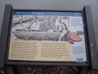
The Original Residents
Pemberton Park Historic Trail
Photographed by Nate Davidson, January 18, 2011
1. The Original Residents Marker
Picture Caption
The illustrations of John White, the basis for this DeBry etching, are an important source of information about the first Americans. White visited coastal Native American villages as far north as the Chesapeake Bay in the 1500s. Stone tools used by native people in this region include a grinding stone,
this page online
Erected by Wicomico County Parks & Tourism, Chesapeake Bay Gateways Network.
Topics. This historical marker is listed in these topic lists: Colonial Era • Indigenous Peoples and Communities.
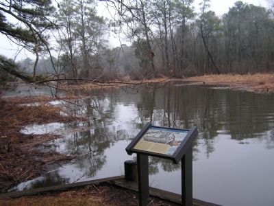
Location. 38° 20.767′ N, 75° 38.7′ W. Marker is in Salisbury, Maryland, in Wicomico County. It can be reached from Pemberton Historic Park Road 0.4 miles Pemberton Drive. Located within Pemberton Park. Touch for map. Marker is in this post office area: Salisbury MD 21801, United States of America. Touch for directions.

Regionally, this marker is on the Eastern Shore. It is also in the American Mid-Atlantic, on the Delmarva Peninsula, in the Tidewater, and on the Eastern Seaboard. Globally, it is in the North Atlantic Region, North America, the Western Hemisphere, the Western World, and the Anglosphere. Historically, it finds itself in what was once one of the original Thirteen Colonies and also the Antebellum South.
Other nearby markers. At least 8 other markers are within walking distance of
Photographed by Nate Davidson, January 18, 2011
2. Marker Location
Another marker is no longer nearby. Pemberton Hall (was about 500 feet away but has been replaced with another marker now near it).
Credits. This page was last revised on June 16, 2016. It was originally submitted on January 22, 2011, by Nathan Davidson of Salisbury, Maryland. This page has been viewed 959 times since then and 49 times this year. Photos: 1, 2. submitted on January 22, 2011, by Nathan Davidson of Salisbury, Maryland. • Bill Pfingsten was the editor who published this page.
