
Yonges Island in Rantowles in Charleston County, South Carolina — The American South (South Atlantic)
St. Paul's, Stono
⎯⎯⎯
St. Paul's Churchyard
Photographed by Mike Stroud, January 2011
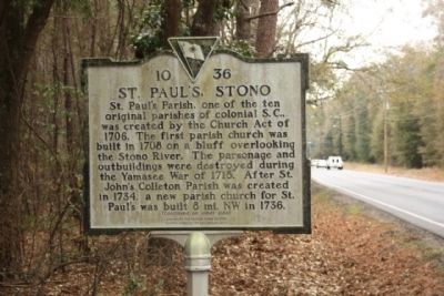
1. St. Paul's, Stono
St. Paul’s Parish, one of the ten original parishes of colonial S.C., was created by the Church Act of 1706. The first parish church was built in 1708 on a bluff overlooking the Stono River. The parsonage and outbuildings were destroyed during the Yamasee War of 1715. After St. John’s Colleton Parish was created in 1734, a new parish church for St. Paul’s was built 8 mi. NW in 1736.
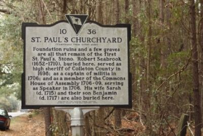
St. Paul's Churchyard
Foundation ruins and a few graves are all that remain of the first St. Paul’s, Stono. Robert Seabrook (1652-1710), buried here, served as high sheriff of Colleton County in 1698; as a captain of militia in 1706; and as a member of the Commons House of Assembly 1706-09, serving as Speaker in 1706. His wife Sarah (d. 1715) and their son Benjamin (d. 1717) are also buried here.
Erected 2002 by The Charles Towne Chapter, Colonial Dames of the XVII Century. (Marker Number 10-36.)
Topics and series. This historical marker is listed in these topic lists: Cemeteries & Burial Sites • Religion & Religious Structures. In addition, it is included in the The Colonial Dames XVII Century, National Society
this page online
Location. 32° 44.923′ N, 80° 10.952′ W. Marker is in Rantowles, South Carolina, in Charleston County. It is on Yonges Island. It is on State Highway 162, on the right when traveling east. Located between Towles Road and Dixie Plantation/ Bryan Road,East of Marvin's Meats. Touch for map. Marker is in this post office area: Hollywood SC 29449, United States of America. Touch for directions.

Regionally, this marker is in the Lowcountry. It is also in the American South, specifically in the Deep South, and on the Eastern Seaboard. Globally, it is in the North Atlantic Region, North America, the Western Hemisphere, the Western World, and the Anglosphere. Historically, it finds itself in what was once the territory of the Mississippian Culture, one of the original Thirteen Colonies, one of the Confederate States of America, and the Antebellum South.
Other nearby markers. At least 8 other markers are within 6 miles of this marker, measured as the crow flies: Plainsfield Plantation (approx. 1.9 miles away); The Stono Rebellion (1739) (approx. 3.3 miles away); Champneys' Pink Cluster
Photographed by Mike Stroud, January 2011
2. St. Paul's Churchyard Marker
Photographed by Mike Stroud, January 2011
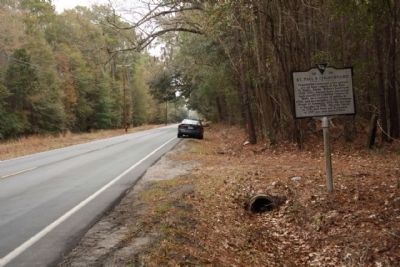
3. St. Paul's, Stono / St. Paul's Churchyard Marker seen looking east along S.C. Hwy. 162
Photographed by Mike Stroud, January 2011
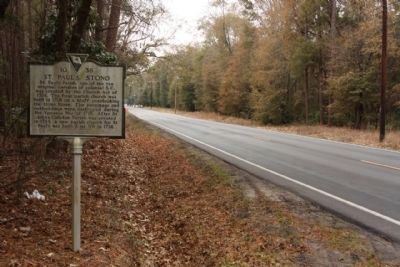
4. St. Paul's, Stono / St. Paul's Churchyard Marker, looking west
Credits. This page was last revised on February 16, 2023. It was originally submitted on January 25, 2011, by Mike Stroud of Bluffton, South Carolina. This page has been viewed 4,854 times since then and 217 times this year. Photos: 1, 2, 3, 4. submitted on January 27, 2011, by Mike Stroud of Bluffton, South Carolina.
