
Americus in Sumter County, Georgia — The American South (South Atlantic)
Confederate Hospitals
Photographed by David Seibert, January 24, 2011
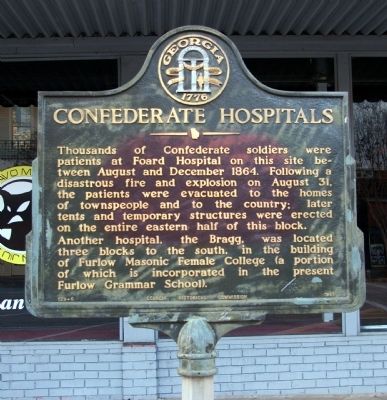
1. Confederate Hospitals Marker
Another hospital, the Bragg, was located three blocks to the south, in the building of Furlow Masonic Female College (a portion of which is incorporated in the present Furlow Grammar School).
Erected 1961 by Georgia Historical Commission. (Marker Number 129-6.)
Topics and series. This historical marker is listed in this topic list: War, US Civil. In addition, it is included in the Georgia Historical Society series list. A significant historical date for this entry is August 31, 1864.
Location. 32° 4.371′ N, 84° 14.033′ W. Marker is in Americus, Georgia, in Sumter County. It is on North Jackson Street 0 miles south of East Forsyth Street (Georgia Route 49), on the right when traveling south. Touch for map. Marker is at or near this postal address: 118 North Jackson Street, Americus GA 31709,
this page online

Regionally, this marker is in Georgia’s Piedmont. It is also in the American South and specifically in the Deep South. Globally, it is in North America, the Western Hemisphere, the Western World, and the Anglosphere. Historically, it finds itself in what was once the territory of the Mississippian Culture, one of the original Thirteen Colonies, one of the Confederate States of America, and the Antebellum South.
Other nearby markers. At least 8 other markers are within walking distance of this marker: The Prather Clinic (about 500 feet away, measured in a direct line); The First Presbyterian Church of Americus (about 600 feet away); The Flood of July 1994 (about 600 feet away); Founders Memorial Park (approx. 0.2 miles away); Sumter County Courthouse Bell (approx. ¼ mile away); Sumter County (approx. 0.3 miles away); Luther H. Story (approx. 0.3 miles away); Sumter County in the Civil Rights Movement (approx. 0.3 miles away). Touch for a list and map of all markers in Americus.
Photographed by David Seibert, January 24, 2011
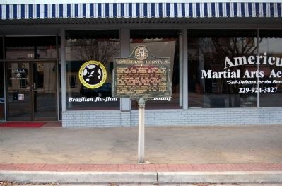
2. Confederate Hospitals Marker
Photographed by David Seibert, January 24, 2011
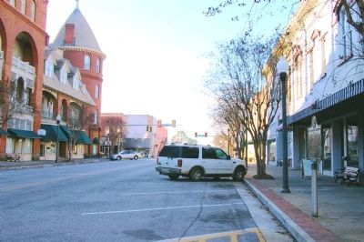
3. Confederate Hospitals Marker
Looking south on North Jackson Street, with Americus' famed Windsor Hotel on the left.
Credits. This page was last revised on September 27, 2024. It was originally submitted on January 28, 2011, by David Seibert of Sandy Springs, Georgia. This page has been viewed 1,012 times since then and 30 times this year. Photos: 1, 2, 3. submitted on January 28, 2011, by David Seibert of Sandy Springs, Georgia. • Craig Swain was the editor who published this page.
