Forest Glen in Brownsville in Albemarle County, Virginia — The American South (Mid-Atlantic)
The Rothwell Family ... ⎯⎯⎯ Elisha Wm. Robertson ...
Photographed by J. J. Prats, July 1, 2007
1. Rothwell Family Face of Marker
Inscription.
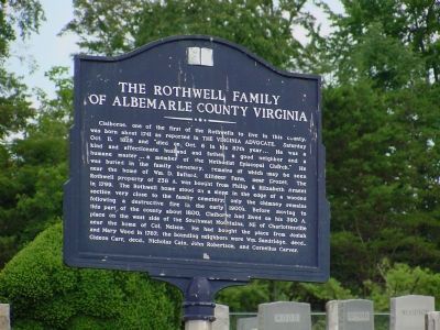
The Rothwell Family of Albemarle County Virginia.
Claiborne one of the first of the Rothwells to live in this county, was born about 1741 as reported in The Virginia Advocate, Saturday Oct. 11, 1828 and “died on Oct. 6 in his 87th year... He was a kind and affectionate husband and father, a good neighbor and a humane master ... a member of the Methodist Episcopal Church.” He was buried in the family cemetery, remains of which may be seen near the home of Wm. D. Ballard, Killdeer Farm, near Crozet. The Rothwell property of 238 acres was bought from Philip & Elizabeth Arnent in 1799. The Rothwell home stood on a slope in the edge of a wooded section very close to the family cemetery;
only the chimney remains following a destructive fire in the early 1900’s. Before moving to this part of the county about 1800, Claiborne had lived on his
Click or scan to see this page online
390 acre place on the west side of the Southwest Mountains, NE of Charlottesville near the home of Col. Nelson. He had bought the place from Josiah and Mary Wood in 1787; the bounding neighbors were Wm. Sandridge, decd., Gideon Carr, decd., Nicholas Cain, John Robertson, and Cornelius Carver.
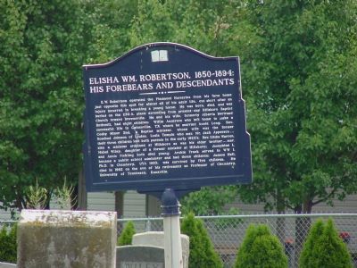
Elisha Wm. Robertson, 1850–1894: His Forebears and Descendants.
E. W. Robertson led the Piedmont Nurseries from his farm home
just opposite this spot for almost all of his adult life, cut short after an injury incurred in breaking a young horse. He was born, died, and was buried on the 230 acre place extending from present-day Hillsboro Baptist Church toward Brownsville. He and his wife, formerly Alberta Bertrand Rothwell, had eight children: Willie Anderson who left home to make a successful life in Gainesville, TX where he married Annie Long; Rev. Cosby Minor 2nd,
Photographed by J. J. Prats, July 1, 2007
2. Elisha Wm. Robertson Side of Marker
a Baptist minister, whose wife was the former Rosebud Johnson of Louisa; Louis Temple who married Mr. Jack Apperson ... their three children lost both parents In the early 1920's; Rev. Elisha Warren, also a minister ordained at Hillsboro as was his older brother... married Mabel Wiley, daughter of a former minister at Hillsboro; Josephine L. and Annis Pickling both died young; Archie Frank served in WW I, became a public school administer and had three children; Judson Hall, Ph.D. in Chemistry, UVA 1920, was survived by five children. He died in 1962 on the eve of his retirement as Professor of Chemistry, University of Tennessee, Knoxville.
Location. 38° 3′ N, 78° 42.517′ W. Marker is in Brownsville,
Photographed by J. J. Prats, July 1, 2007
3. The Rothwell Family Side of Marker
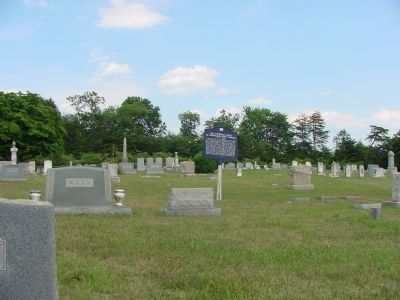
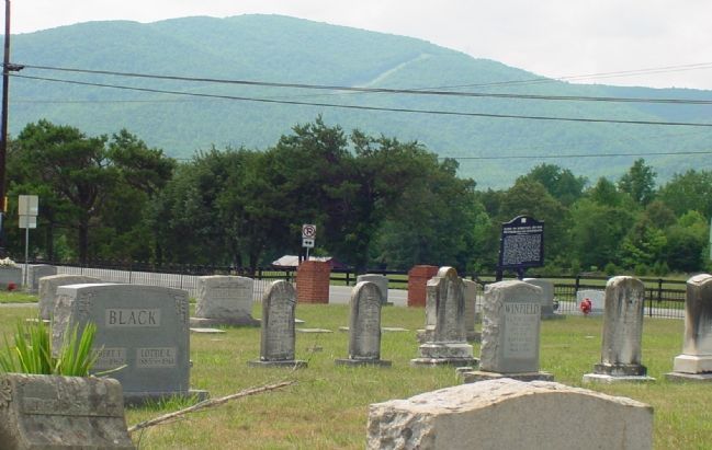
Virginia, in Albemarle County. It is in Forest Glen. It is on Rockfish Gap Turnpike (U.S. 250) west of Crozet Avenue / Miller School Road (Virginia Route 240), on the right when traveling east. Marker is in Hillsboro Cemetery. Touch for map. Marker is in this post office area: Crozet VA 22932, United States of America. Touch for directions.
Regionally, this marker is in the Piedmont and in Central Virginia. It is also in the American South and specifically in the Upper South. Globally, it is in North America, the Western Hemisphere, the Western World, and the Anglosphere. Historically, it finds itself in what was once the territory of the Mississippian Culture, one of the original Thirteen Colonies, one of the Confederate States of America, and the Antebellum South.
Other nearby markers. At least 8 other markers are within 5 miles of this marker,
Another marker is no longer nearby. Jackson’s Valley Campaign (was approx. 3½ miles away but has been replaced with another marker now near it).
Additional commentary. 1. Rothwell farm (Killdeer) The farm that was described is now part of a new housing development. The cemetery will be between two townhouses, but the developer has pledged to rebuild the stone wall around the cemetery, and maintain it. I have been in Charlottesville since about 1996, and
Photographed by J. J. Prats, July 1, 2007
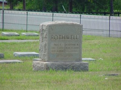
5. A Rothwell Gravestone
“Paul E., Dec. 7, 1859 – July 4, 1930. Josephine W. Mar 12, 1859 - (illegible). We will meet again.”
have been working in the cemetery since then during the summers. When I first went to it, it was nearly impossible to enter the cemetery, as it was totally overgrown and most of the markers were knocked down. It is now cleared, and the markers raised when possible. There are a number of field stone marked graves, and I believe Clairborne and Judy are buried under them, as there is no marker for them.
If you happen to watch the movie Evan Almighty, the ark was built on the property across Lickinghole creek, and on top of a hill on the property. I have not seen the film, but if they show a housing tract in the background (not the houses NEXT to the ark) that is where the cemetery is. The chimney mentioned earlier is still there as of June 2007, with a large tree growing adjacent to it. Since I was not aware this was the original house, I did not do any digging around
Photographed by Paul Crumlish, September 19, 2009
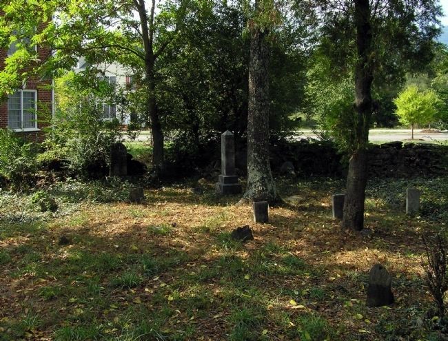
6. The Rothwell Family Cemetery
The Rothwell Family Cemetery, now surrounded by townhouses in the planned community of Old Trail, in Crozet.
the chimney. The road to another part of the development passes close by, so some of the house grounds may have been disturbed. There is/was a road named Rothwell lane that originally led to the farm gate, but I am not sure if it will survive the development. Note To Editor only visible by Contributor and editor
— Submitted January 29, 2008, by Kenneth Rothwell of Charlottesville, Virginia.
2. Greetings from Rothwell (from Claiborne) in Tenn I just chanced and searched for Albemarle County to see how many Rothwell's perhaps were listed and ran across the pic of this marker.
— Submitted July 1, 2016.
Credits. This page was last revised on February 1, 2023. It was originally submitted on December 5, 2007, by J. J. Prats of Powell, Ohio. This page has been viewed 4,913 times since then and 97 times this year. Photos:1, 2, 3, 4, 5. submitted on December 5, 2007, by J. J. Prats of Powell, Ohio. 6. submitted on September 19, 2009, by PaulwC3 of Northern, Virginia.