Lloyds in Dorchester County, Maryland — The American Northeast (Mid-Atlantic)
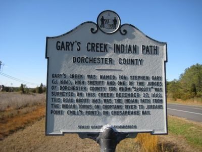
Gary’s Creek - Indian Path
Dorchester County
Erected by State Roads Commission.
Topics. This historical marker is listed in these topic lists: Colonial Era • Government & Politics • Native Americans • Settlements & Settlers. A significant historical date for this entry is December 27, 1767.
Location. 38° 35.279′ N, 76° 10.672′ W. Marker is in Lloyds, Maryland, in Dorchester County. Marker is at the intersection of Hudson Road (Maryland Route 343) and Spocott Lane, on the left when traveling west on Hudson Road. Touch for map. Marker is in this post office area: Cambridge MD 21613, United States of America. Touch for directions.
Other nearby markers. At least 8 other markers are within 5 miles of this marker, measured as the crow flies. Spocott Windmill (approx. 0.2 miles away); The Adaline Wheatley House (approx. 0.2 miles away); The Castle Haven School (approx. 0.2 miles away); a different marker also named The Spocott Windmill (approx. 0.2 miles away); How a Post Windmill Works (approx. 0.2 miles away); “The Wilderness” (approx. 4.6 miles away); Annie Oakley House (approx. 4.8 miles away); Stanley Institute (approx. 5 miles away). Touch for a list and map of all markers in Lloyds.
Credits. This page was last revised on June 16, 2016. It was originally submitted on December 5, 2007, by F. Robby of Baltimore, Maryland. This page has been viewed 1,750 times since then and 16 times this year. Photo 1. submitted on December 5, 2007, by F. Robby of Baltimore, Maryland.
