North Springfield in Fairfax County, Virginia — The American South (Mid-Atlantic)
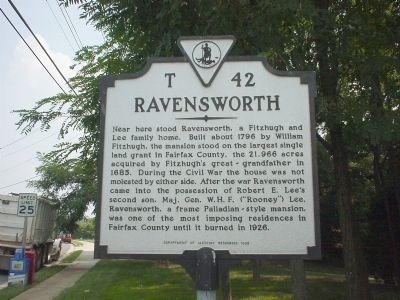
Ravensworth
Erected 1992 by Department of Historic Resources. (Marker Number T-42.)
Topics and series. This historical marker is listed in these topic lists: Agriculture • Architecture • Settlements & Settlers • War, US Civil. In addition, it is included in the Virginia Department of Historic Resources (DHR) series list. A significant historical year for this entry is 1796.
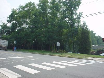
Location. 38° 48.58′ N, 77° 13.271′ W. Marker is in North Springfield, Virginia, in Fairfax County. Marker is on Port Royal Road just south of Braddock Road (County Route 620), on the right when traveling south. Port Royal Road is on the west side of the intersection of Braddock Road and the Capital Beltway (Interstate 495). Touch for map. Marker is at or near this postal address: 5238 Port Royal Rd, Springfield VA 22151, United States of America. Touch for directions.
Other nearby markers. At least 5 other markers are within 2 miles of this marker, measured as the crow flies. A different marker also named Ravensworth (within shouting distance of this marker); Connecting Communities and Parks (approx. 1.2 miles away); Orange and Alexandria Railroad (approx. 1.2 miles away); The Civilian Conservation Corps (approx. 1˝ miles away); a different marker also named Orange and Alexandria Railroad (approx. 1˝ miles away). Touch for a list and map of all markers in North Springfield.
Also see . . . Ravensworth: A Short History of Annandale, Virginia. by Audrey B. Capone. (Submitted on October 15, 2006.)
Credits. This page was last revised on January 27, 2022. It was originally submitted on December 22, 2005, by J. J. Prats of Powell, Ohio. This page has been viewed 3,566 times since then and 74 times this year. Photos: 1, 2. submitted on December 22, 2005.

