Marblehead in Ottawa County, Ohio — The American Midwest (Great Lakes)
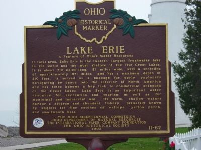
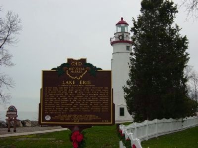
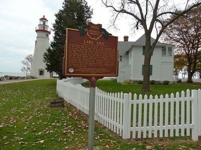
Lake Erie
A Feature of Ohio's Water Resources
Erected 2003 by The Ohio Bicentennial Commission, Ohio Department of Natural Resources, The International Paper Company Foundation, The Ohio Historical Society. (Marker Number 11-62.)
Topics and series. This historical marker is listed in these topic lists: Exploration • Industry & Commerce • Waterways & Vessels. In addition, it is included in the Ohio Historical Society / The Ohio History Connection series list.
Location. 41° 32.183′ N, 82° 42.733′ W. Marker is in Marblehead, Ohio, in Ottawa County . Marker can be reached from Lighthouse Drive, 0.1 miles east of East Main Street (Ohio Route 163). Located on the grounds of the Marblehead Lighthouse. Touch for map. Marker is at or near this postal address: 110 Lighthouse Drive, Lakeside Marblehead OH 43440, United States of America. Touch for directions.
Other nearby markers. At least 8 other markers are within 2 miles of this marker, measured as the crow flies. Marblehead Lighthouse (a few steps from this marker); The View From Here (within shouting distance of this marker); a different marker also named The View From Here (within shouting distance of this marker); The Light / The Keepers of the Light (within shouting distance of this marker); USS Wasp CV7 Memorial (approx. 0.8 miles away); Danbury Township Veterans Memorial (approx. 1.1 miles away); Home Of The First Marblehead Village Newspaper (approx. 1.2 miles away); First Congregational Church (approx. 1.2 miles away). Touch for a list and map of all markers in Marblehead.
Credits. This page was last revised on May 17, 2020. It was originally submitted on February 3, 2011, by Mike Wintermantel of Pittsburgh, Pennsylvania. This page has been viewed 902 times since then and 11 times this year. Photos: 1, 2. submitted on February 3, 2011, by Mike Wintermantel of Pittsburgh, Pennsylvania. 3. submitted on November 17, 2015, by Denise Boose of Tehachapi, California. • Bernard Fisher was the editor who published this page.


