Bluemont in Loudoun County, Virginia — The American South (Mid-Atlantic)
Bluemont Historic District
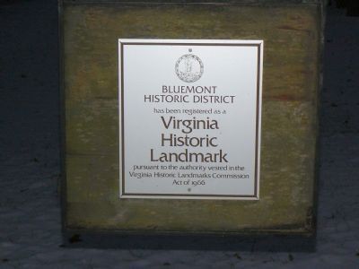
Bluemont Historic District has been registered as a Virginia Historic Landmark pursuant to the authority vested in the Virginia Historic Landmarks Commission Act of 1966.
Topics and series. This historical marker is listed in these topic lists: Landmarks • Railroads & Streetcars • Roads & Vehicles • War, US Civil. In addition, it is included in the Washington and Old Dominion (W&OD) Railroad series list. A significant historical year for this entry is 1966.
Location. 39° 6.655′ N, 77° 50.07′ W. Marker is in Bluemont, Virginia, in Loudoun County. Marker is at the intersection of Snickersville Turnpike (County Route 734) and Clayton Hall Road (County Route 760), on the left when traveling west on Snickersville Turnpike. Marker is directly across 734 where 760 tees into it. Touch for map. Marker is in this post office area: Bluemont VA 20135, United States of America. Touch for directions.
Other nearby markers. At least 8 other markers are within one mile of this marker, measured as the crow flies. Snickersville Turnpike (a few steps from this marker); Bluemont (a few steps from this marker); The Snickersville Academy (within shouting distance of this marker); The Lives And Times Of The Snickersville Academy (about 400 feet away, measured in a direct line); a different marker also named Snickersville Turnpike (approx. 0.4 miles away); Mt. Airy Fight (approx. ¾ mile away); Lt. Col. Roger Preston Chew (1843-1921) (approx. 0.8 miles away); Appalachian Trail and Bears Den (approx. one mile away). Touch for a list and map of all markers in Bluemont.
Regarding Bluemont Historic District. The unincorporated town of Bluemont, formerly Snickersville, dates back to pre-Revolutionary days. It was the western terminus of the Washington & Old Dominion railroad.
Also see . . .
1. Snickersville Turnpike Association. Association website homepage (Submitted on December 8, 2007.)
2. Bluemont Historic District. Virginia Department of Historic Resources website entry (Submitted on December 9, 2007, by Craig Swain of Leesburg, Virginia.)
Additional commentary.
1. Bluemont Historic District
In more recent years, three organizations have worked to try to preserve the scenic character of the area. The Bluemont Citizens Association has coordinated the Bluemont Fair each year since the 1970s. The Snickersville Turnpike Association (link 1 above) has worked to keep Rt. 734
Photographed By Franklin Bell, December 8, 2007
2. Recollections of a 1850s Snickersville Resident
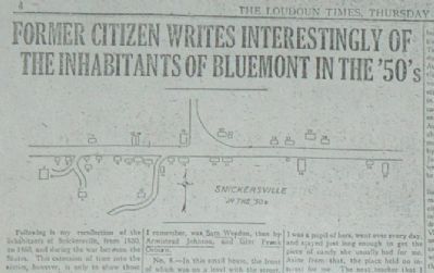
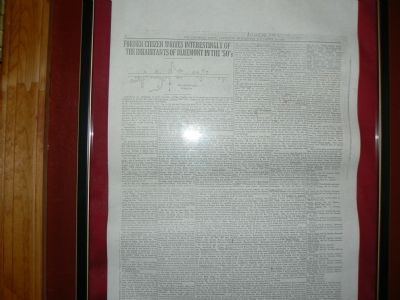
This is a photo of a copy of page 4 of The Loudoun Times of Thursday, Nov. 29, 1923, which published the remembrances of Thomas Osburn, who, as a boy, lived in Snickersville from 1850 to 1860. With a simple map that numbered the buildings in the village, Osburn described the people who lived and worked there just before the Civil War. The most fascinating description pertains to No. 21. See accompanying photo caption for details.
— Submitted December 8, 2007, by Franklin Bell of Bluemont, Virginia.
2. From “Virginia: The WPA Guide to the Old Dominion”
In 1940, under Franklin Roosevelt’s New Deal, the Works Progress Administration's Federal Writers Project produced guides to the individual states. In detailing the 71-mile trip from Alexanderia to Winchester (Tour 13), the Guide reports:
“At 51.5 m. is a junction with State 245.”
“Left here steeply to BLUEMONT, 0.4 m., a handful of houses and a store or two at the foot of the mountain whose slopes are covered with hepatica in the spring. Until 1900, the hamlet was called Snickersville. Glimpsed through the trees on the mountainside are many summer homes of Washington’s official and diplomatic set.”
— Submitted March 13, 2008, by Franklin Bell of Bluemont, Virginia.
Additional keywords. Snickersville, Snickersville Turnpike, Snickers Gap, W&OD Railroad, Gen. Sheridan
Photographed By Franklin Bell, December 8, 2007
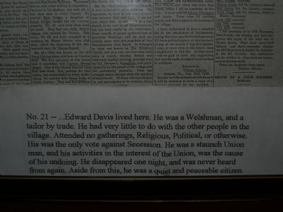
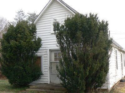
4. `Aside from this, he was a quiet and peaceable citizen.'
Building No. 21 on Thomas Osburn's map of Snickersville in the 1850s: "...Edward Davis lived here. He was a Welshman, and a tailor by trade. He had very little to do with th other people in the village. Attended no gatherings, Religious, Political, or otherwise. His was the only vote against Secession. He was a staunch Union man, and his activities in the interest of the Union, was the cause of his undoing. He disappeared one night, and was never heard from again. Aside from this, he was a quiet and peaceable citizen."
Photographed By Franklin Bell, December 21, 2007
7. Bluemont PO, early 1950s to 1991
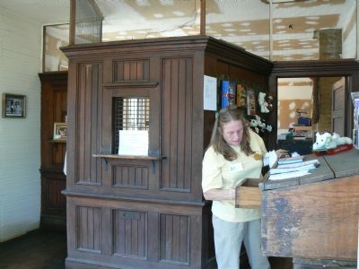
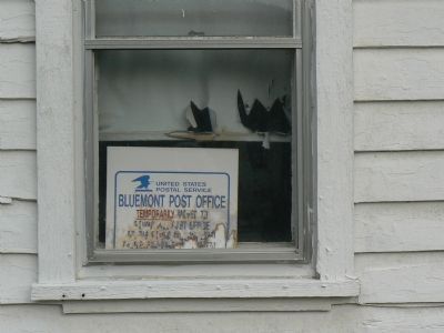
In the early 1950s, the Post Office moved across Railroad Street (formerly Elizabeth Street) (Rt. 753) to this small structure. Operations ceased in 1991. From 1991 to 1995 Bluemont residents had to go to nearby Round Hill to get their mail. In 1995, a new Post Office was finally opened in Bluemont, restoring one of the essential elements of the community.
Photographed By Franklin Bell, December 22, 2007
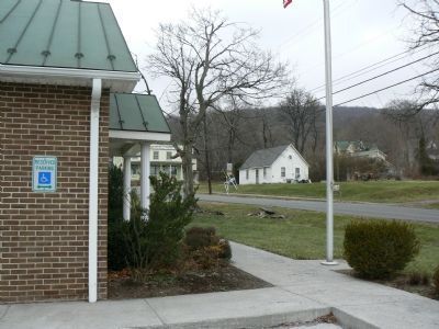
9. Three POs within a Stone's Throw
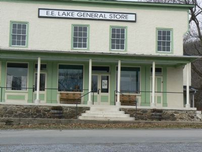
Looking past the new (1995) Post Office on the left, you see the E.E. Lake General Store (center), which housed the Post Office into the early 1950s, and the current Post Office's predecessor on the right. Uniquely, Bluemont's current zip code--20135--encompasses portions of three counties (Loudoun, Clarke, and Jefferson) and two states (Virginia and West Virginia).
Photographed By Franklin Bell, December 8, 2007
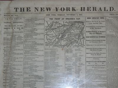
10. The Fight At Snicker's Gap
This is a photograph of the front page of The New York Herald of Nov. 4, 1862, the day of the Congressional elections. The map of the region situates the skirmish at Snicker's Gap Nov. 2, in which Union forces advanced toward the crucial Shenandoah Valley.
Photographed By Franklin Bell, December 21, 2007
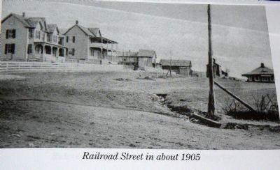
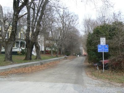
12. The view down Railroad Street from about the same spot about a century later.
The building at the far end of the road was once a mill, and is being restored. The building on the left with the double porch, now a residence, was once known as the Blue Ridge Inn.
Credits. This page was last revised on August 4, 2022. It was originally submitted on December 7, 2007, by Franklin Bell of Bluemont, Virginia. This page has been viewed 3,725 times since then and 49 times this year. Photos: 1, 2, 3, 4. submitted on December 8, 2007, by Franklin Bell of Bluemont, Virginia. 5, 6, 7, 8, 9. submitted on December 22, 2007, by Franklin Bell of Bluemont, Virginia. 10. submitted on December 8, 2007, by Franklin Bell of Bluemont, Virginia. 11, 12. submitted on December 23, 2007, by Franklin Bell of Bluemont, Virginia. • J. J. Prats was the editor who published this page.
