Duncan Chapel Community in Dorchester County, South Carolina — The American South (South Atlantic)
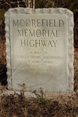
Moorefield Memorial Highway
(U.S. Route 178)
Photographed by Mike Stroud, 2011
1. Moorefield Memorial Highway Marker
Charles Henry Moorefield
State Highway Engineer
of South Carolina
1920 — 1935
Topics. This historical marker is listed in this topic list: Roads & Vehicles. A significant historical year for this entry is 1920.
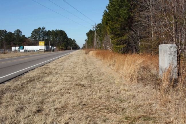
Location. 33° 16.51′ N, 80° 34.8′ W. Marker is in Duncan Chapel Community, South Carolina, in Dorchester County. It is on Charleston Highway (U.S. 178) just north of Shady Grove Road, on the right when traveling north. Touch for map. Marker is in this post office area: Bowman SC 29018, United States of America. Touch for directions.

Regionally, this marker is in the Lowcountry. It is also in the American South, specifically in the Deep South, and on the Eastern Seaboard. Globally, it is in the North Atlantic Region, North America, the Western Hemisphere, the Western World, and the Anglosphere. Historically, it finds itself in what was once the territory of the Mississippian Culture, one of the original Thirteen Colonies, one of the Confederate States of America, and the Antebellum South.
Other nearby markers. At least 8 other markers are within 8 miles of this marker, measured as the crow flies: Shady Grove Camp Ground (approx. 0.9 miles away); Astronaut Frank L. Culbertson, Jr. (approx. 3½ miles away); Badham House / Dorchester Lumber Company (approx. 5.8 miles away); St. George Public High School / St. George Graded School (approx. 6 miles away); Town of St. George (approx. 6.2 miles away); South Carolina Canal & Rail Road Company (approx. 6.4 miles away); St. Paul Camp Ground (approx. 7½ miles away); Bowman Rosenwald School (approx. 7.8 miles away).
Regarding Moorefield Memorial Highway. U.S. Highway 178 is a spur of U.S. Highway 78. It currently runs for 237 miles (381 km) from Dorchester, South Carolina at U.S. Highway 78 to Rosman, North Carolina at U.S.
this page online
Photographed by Mike Stroud, January 16, 2011
2. Moorefield Memorial Highway Marker, seen looking north along US 178
Credits. This page was last revised on June 16, 2016. It was originally submitted on February 17, 2011, by Mike Stroud of Bluffton, South Carolina. This page has been viewed 1,588 times since then and 131 times this year. Photos: 1, 2. submitted on February 17, 2011, by Mike Stroud of Bluffton, South Carolina.
