Near Page in Coconino County, Arizona — The American Mountains (Southwest)
Concrete Bucket
⎯⎯⎯
Concrete Core Sample
Reclamation: Managing Water in the West

Photographed by William Fischer, Jr., November 13, 2010
1. Concrete Bucket / Concrete Core Sample Marker
Concrete Bucket
This is one of several concrete buckets that poured the concrete in Glen Canyon Dam. Each bucket held 24 tons (22 metric tons) of concrete and it took over 400,000 buckets to complete the dam. The first pour of concrete occurred on June 17, 1960, the start of an around-the-clock process that continued uninterrupted until September of 1963.
Concrete Core Sample
The polished core cylinder shows the kind of materials that make up the dam. The imbedded rocks are aggregate (gravel) from the streambed near Wahweap Creek, 8 miles (13 kilometers) away from the dam. Other materials include limestone cement from Clarkdale, Arizona; pozzolan (a kind of volcanic ash) from near Flagstaff, Arizona; and fly ash.
Erected by Bureau of Reclamation.
Topics. This historical marker is listed in these topic lists: Industry & Commerce • Waterways & Vessels. A significant historical year for this entry is 1960.
Location. 36° 56.178′ N, 111° 29.178′ W. Marker is near Page, Arizona, in Coconino County. It can be reached from U.S. 89. Marker is on top of the Glen Canyon Dam, off US Route 89 at the Colorado River. Touch for map.
this page online

Regionally, this marker is in Flagstaff & High Country, in the Navajo Nation, and in Hopi. It is also in the American Southwest, in the Mountain West, on the Colorado Plateau, and at the Four Corners. Globally, it is in North America, the Western Hemisphere, the Western World, and the Anglosphere. Historically, it finds itself in what was once New Spain and also Mexico’s Alta California.
Other nearby markers. At least 8 other markers are within walking distance of this marker: Wicket Gates (a few steps from this marker); Turbine Runner (within shouting distance of this marker); Rock Bolts / High Scaling (within shouting distance of this marker); Hydroelectric Power - A Green and Renewable Energy Source (within shouting distance of this marker); Lake Powell (within shouting distance of this marker); Bureau of Reclamation Memorial Fountain (within shouting distance of this marker); Dinosaur Tracks (about 300 feet away, measured in a direct line); Intake Structures (about 400 feet away). Touch for a list and map of all markers
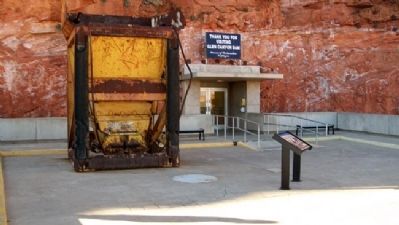
Photographed by William Fischer, Jr., November 13, 2010
2. Concrete Bucket and Marker
Also see . . . Glen Canyon National Recreation Area. (Submitted on February 17, 2011, by William Fischer, Jr. of Reynoldsburg, Ohio.)
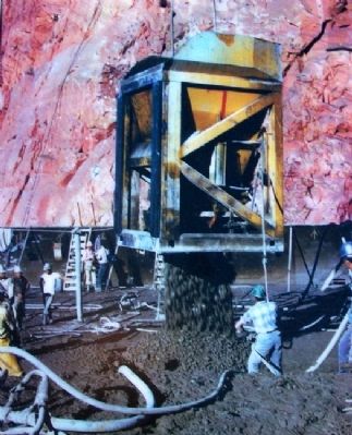
Photographed by Bureau of Reclamation, October 1961
3. Photo on Concrete Bucket Marker
[Caption reads] Pouring Concrete
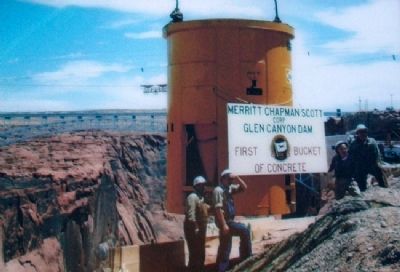
Photographed by Bureau of Reclamation, June 17, 1960
4. Photo on Concrete Bucket Marker
[Caption reads] First bucket of concrete
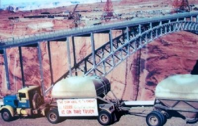
Photographed by Bureau of Reclamation, March 1962
5. Photo on Concrete Bucket Marker
[Caption reads] Cement haulage is one-half complete
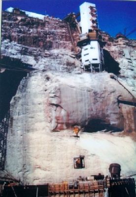
Photographed by Bureau of Reclamation, 1961
6. Photo on Concrete Bucket Marker
[Caption reads] Concrete bucket is lowered from the batch plant on the canyon rim
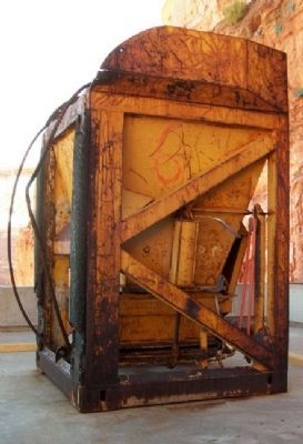
Photographed by William Fischer, Jr., November 13, 2010
7. Glen Canyon Dam Concrete Bucket
Credits. This page was last revised on August 29, 2020. It was originally submitted on February 17, 2011, by William Fischer, Jr. of Reynoldsburg, Ohio. This page has been viewed 1,478 times since then and 25 times this year. Photos: 1, 2, 3, 4, 5, 6, 7. submitted on February 17, 2011, by William Fischer, Jr. of Reynoldsburg, Ohio.
