Near Page in Coconino County, Arizona — The American Mountains (Southwest)
Intake Structures
Reclamation: Managing Water in the West
Inscription.
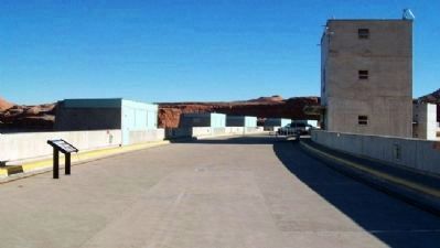
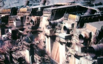
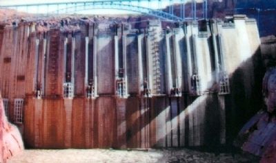
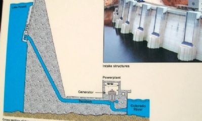
The eight small "buildings" on the upstream face of the dam contain equipment to operate the penstock gates. Each penstock is 15 feet (4.6 meters) in diameter and carries water to one of the turbine generators in the powerplant.
Erected by Bureau of Reclamation, U.S. Department of the Interior.
Topics. This historical marker is listed in these topic lists: Industry & Commerce • Waterways & Vessels.
Location. 36° 56.234′ N, 111° 29.143′ W. Marker is near Page, Arizona, in Coconino County. Marker is on top of the Glen Canyon Dam, off US Route 89 at the Colorado River. Touch for map. Marker is in this post office area: Page AZ 86040, United States of America. Touch for directions.
Other nearby markers. At least 8 other markers are within walking distance of this marker. Colorado River Storage Project / Glen Canyon Dam (within shouting distance of this marker); Hydroelectric Power - A Green and Renewable Energy Source (within shouting distance of this marker); Rock Bolts / High Scaling (within shouting distance of this marker); Glen Canyon Bridge / Cableways (within shouting distance of this marker); Wicket Gates (about 300 feet away, measured in a direct line); Concrete Bucket / Concrete Core Sample (about 400 feet away); Glen Canyon Dam (about 400 feet away); Turbine Runner (about 500 feet away). Touch for a list and map of all markers in Page.
Also see . . . Glen Canyon National Recreation Area. (Submitted on February 18, 2011, by William Fischer, Jr. of Scranton, Pennsylvania.)
Credits. This page was last revised on August 16, 2020. It was originally submitted on February 18, 2011, by William Fischer, Jr. of Scranton, Pennsylvania. This page has been viewed 1,007 times since then and 9 times this year. Photos: 1, 2, 3, 4. submitted on February 18, 2011, by William Fischer, Jr. of Scranton, Pennsylvania.
Editor’s want-list for this marker. Close photo of full marker and text • Can you help?


