Near Keedysville in Washington County, Maryland — The American Northeast (Mid-Atlantic)
Pry Family Upheaval
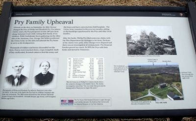
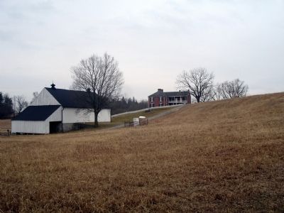
A knock on the door on September 16, 1862, forever changed the lives of Philip and Elizabeth Pry. For almost twenty years, the Prys prospered on this 140-acre farm along Antietam Creek while raising their family of six children. With Confederate forces gathering on the other side of the Antietam, Gen. George McClellan positioned the Union Army on this side and selected the Pry home to serve as his headquarters.
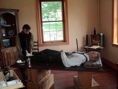
Thousands of soldiers and horses descended on this farm. Fences were knocked down, crops trampled, loads of hay confiscated, livestock taken to feed the army, and the house and barn converted into field hospitals.
After the battle, Phillip Pry filed numerous claims with the War Department for damages to his farm. Portions of the claims were paid, other charges were disputed and there was an investigation of overpayment. The financial burden proved too much. In 1874 the Prys sold their home and moved to Tennessee.
Erected by Antietam National Battlefield - National Park Service - U.S. Department of the Interior.
Topics. This historical marker is listed in this topic list: War, US Civil. A significant historical month for this entry is September 1900.
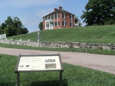
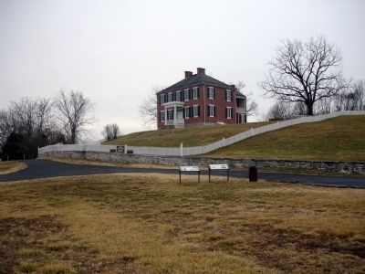
Location. 39° 28.552′ N, 77° 42.818′ W. Marker is near Keedysville, Maryland, in Washington County . Marker can be reached from Shepherdstown Pike (Maryland Route 34). Marker is located at the Pry House Field Hospital Museum. Touch for map. Marker is at or near this postal address: 18906 Shepherdstown Pike, Keedysville MD 21756, United States of America. Touch for directions.
Other nearby markers. At least 8 other markers are within walking distance of this marker. Army Headquarters (here, next to this marker); Second Army Corps (approx. ¼ mile away); Humphreys' Division, Fifth Army Corps (approx. half a mile away); Morell's Division, Fifth Army Corps (approx. half a mile away); Fifth Army Corps (approx. half a mile away); a different marker also named Second Army Corps (approx. half a mile away); Richardson's Division, Second Army Corps (approx. half a mile away); Pry’s Mill Bridge (approx. 0.6 miles away). Touch for a list and map of all markers in Keedysville.
More about this marker. On the lower left of the marker are two portraits captioned, Photographs of Philip and Elizabeth Pry taken in Tennessee years after the battle. At the time of the battle the Prys had six children ranging in age from one to fourteen. The 1860 census showed two free African-American women living in the household—Amanda Samper, age twenty, and Georgiana Rollins, age twelve. The middle of the marker displays a list captioned, This list from one of Philip Pry’s claims shows the extensive damage to his family’s farm. The claims investigation stated
that “the war made him poor and he immigrated to Tennessee to begin life anew.” On the upper right of the marker is a photo captioned, Photograph of the Pry Farm at the time of the battle.
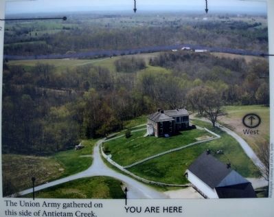
On the lower right is a photo which labels six locations with black arrows and captions. The locations labeled are (clockwise from bottom center):
-YOU ARE HERE
-The Union Army gathered on this side of Antietam Creek
- The Confederate Army gathered on the high ground west of Antietam Creek
- Visitor Center is 1.5 miles west
- Mumma Barn
- Antietam Creek flows through this line of trees from right to left
The bottom of the marker notes that The Pry House Field Hospital Museum is open through a partnership between the National Park Service and the National Museum of Civil War Medicine.
Also see . . .
1. Plan Your Trip To The Pry House Field Hospital Museum. National Museum of Civil War Medicine website entry (Submitted on February 21, 2011.)
2. Pry House Field Hospital Museum. National Park Service website entry (Submitted on February 21, 2011.)
Credits. This page was last revised on March 29, 2022. It was originally submitted on February 21, 2011. This page has been viewed 1,267 times since then and 19 times this year. Photos: 1. submitted on February 21, 2011. 2. submitted on August 23, 2013, by Bill Coughlin of Woodland Park, New Jersey. 3, 4, 5. submitted on February 21, 2011. 6. submitted on August 23, 2013, by Bill Coughlin of Woodland Park, New Jersey. • Craig Swain was the editor who published this page.
