Pyrmont in Carroll County, Indiana — The American Midwest (Great Lakes)
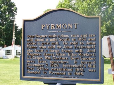
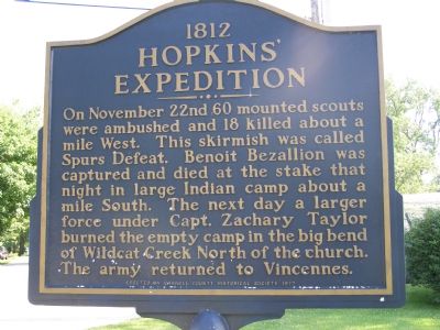
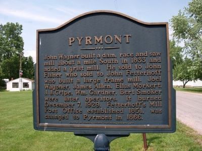
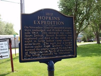
Pyrmont / 1812 Hopkins’ Expedition
1812 Hopkins’ Expedition.
Erected 1977 by Carroll County Historical Society.
Topics and series. This historical marker is listed in these topic lists: Industry & Commerce • Native Americans • Settlements & Settlers • War of 1812. In addition, it is included in the Former U.S. Presidents: #12 Zachary Taylor series list. A significant historical month for this entry is November 1878.
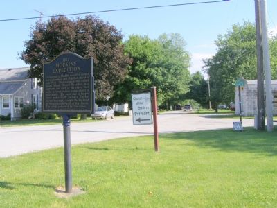
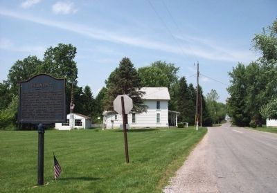
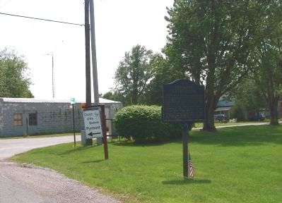
Location. 40° 28.049′ N, 86° 40.801′ W. Marker is in Pyrmont, Indiana, in Carroll County. Marker is at the intersection of South 800 West and West 550 South on South 800 West. Touch for map. Marker is in this post office area: Delphi IN 46923, United States of America. Touch for directions.
Other nearby markers. At least 8 other markers are within 8 miles of this marker, measured as the crow flies. Lancaster Covered Bridge (approx. 3.3 miles away); Prophet’s Town (approx. 7.9 miles away); Paper Mill Complex (approx. 8 miles away); Margaret Fry (approx. 8 miles away); Wabash and Erie Canal (approx. 8 miles away); Wabash And Erie Canal (approx. 8 miles away); Commerce & Culture (approx. 8 miles away); Welcome To Canal Park (approx. 8 miles away).
Additional commentary.
1.
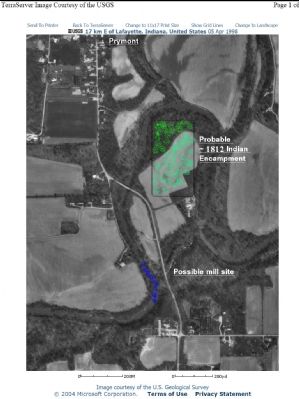
The sign verbiage is not completely accurate regarding the mill. There were two mill locations. The first mill was built by John Wagoner (my ancestor), circa 1830. However, the first mill was not destroyed by fire and is not where the stone foundation exists today. The first mill was located about a ¼ mile north of the second mill location on property I presently own. All evidence of the first mill location was apparently removed when the 1913 flood changed the path of the Wildcat Creek to where the first mill’s race way was located. The second mill was destroyed by fire in 1929 a few years after my grandfather operated it.
— Submitted January 12, 2019, by Glen Miller of Delphi, Indiana.
Credits. This page was last revised on January 16, 2019. It was originally submitted on June 13, 2007, by Christopher Light of Valparaiso, Indiana. This page has been viewed 4,135 times since then and 44 times this year. Last updated on February 22, 2011, by Donald Gradeless of Winona Lake, Indiana. Photos: 1, 2, 3, 4. submitted on June 13, 2007, by Christopher Light of Valparaiso, Indiana. 5, 6, 7, 8. submitted on June 17, 2011, by Al Wolf of Veedersburg, Indiana. • Kevin W. was the editor who published this page.
