St. Augustine in St. Johns County, Florida — The American South (South Atlantic)
650 Julia Street
ACCORD Freedom Trail
Photographed by Mrs. Shirley Williams-Galvin, March 5, 2011
1. 650 Julia Street Marker
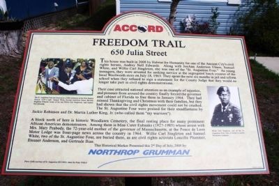
A block north of here is historic Woodlawn Cemetery, the final resting place for many prominent African Americans.
this page online
The movement in St. Augustine led directly to the passage of the landmark Civil Rights Act of 1964.
This Historical Marker Presented this 2nd Day of July, 2009 by Northrop Grumman
Erected 2009 by The 40th Anniversary to Commemorate the Civil Rights Demonstrations, Inc. (ACCORD).
Topics and series. This historical marker is listed in these topic lists: African Americans • Civil Rights • Heroes. In addition, it is included in the Florida, St. Augustine Freedom Trail series list. A significant historical month for this entry is January 1964.
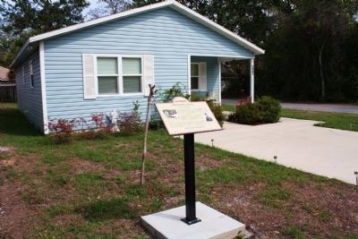
Location. 29° 53.722′ N, 81° 20.237′ W. Marker is in St. Augustine, Florida, in St. Johns County. It is on Julia Street. Touch for map. Marker is at or near this postal address: 650 Julia Street, Saint Augustine FL 32084,
Photographed by Mrs. Shirley Williams-Galvin, March 5, 2011
2. 650 Julia Street and Marker

Regionally, this marker is in First Coast and in Greater Jacksonville. It is also in the American South and on the Eastern Seaboard. Globally, it is in the North Atlantic Region, North America, a Gulf of Mexico state, the Western Hemisphere, the Western World, and the Anglosphere. Historically, it finds itself in what was once New Spain, the territory of the Mississippian Culture, one of the Confederate States of America, and the Antebellum South.
Other nearby markers. At least 8 other markers are within walking distance of this marker: Evergreen Cemetery (about 500 feet away, measured in a direct line); Randolph Caldecott (about 700 feet away); San Sebastian Cemetery (about 700 feet away); Pinehurst Cemetery (approx. 0.2 miles away); New Augustine Colored Elementary School #36 (approx. ¼ mile away); Zion Baptist Church (approx. 0.3 miles away); 96 Evergreen Avenue (approx. 0.3 miles away); S.D.W. Smith, Ancient City, Mt. Horeb #20 (approx. 0.4 miles away). Touch for a list and map of all markers in St. Augustine.
Also see . . . The ACCORD Freedom Trail. Website homepage (Submitted on March 6, 2011, by Gwendolyn Duncan of St. Augustine, Florida.)
Credits. This page was last revised on September 20, 2021. It was originally submitted on March 6, 2011, by Gwendolyn Duncan of St. Augustine, Florida. This page has been viewed 1,235 times since then and 33 times this year. Photos: 1, 2. submitted on March 6, 2011, by Gwendolyn Duncan of St. Augustine, Florida. • Bill Pfingsten was the editor who published this page.
