Hiawatha in Minneapolis in Hennepin County, Minnesota — The American Midwest (Upper Plains)
Main Entrance Minnehaha Lower Glen
Photographed by Keith L, October 16, 2008
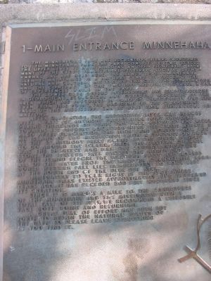
1. Main Entrance Minnehaha Lower Glen Marker
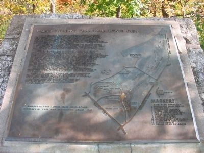
The Minneapolis Park and Recreation Board welcomes you to Minnehaha Park. The park consists of two levels: The upper level is maintained as an open picnicking area. Many of the city's traditional festivals such as Svenskarnas Dag are held here. The lower level – Minnehaha Glen – is maintained in a natural state to preserve the natural and cultural history of the city. The combination and the contrast of the two provide you, the user, a variety of experience while in the park.
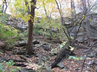
The lower glen offers interesting and simple lessons in geological, ecological and cultural histories of the area which are inscribed in plaques throughout the glen. Even from this point, the receding of the St. Anthony Falls, up the Mississippi can be read from geological formations.
After glaciation, the Mississippi River was formed with a fall (St. Anthony Falls) near Fort Snelling. During thousands of years this fall moved up the river towards its present location near the Third Avenue Bridge. Also after glaciation, the high land across from you was an island on the Mississippi with a channel on each side. As the St. Anthony Falls moved
this page online
Immediately to your right is the spot where Minnehaha Falls existed approximately five thousand years ago. It has receded 500 feet westward since its creation.
Since it is almost a mile to the confluence of the Minnehaha and the Mississippi with a total fall of 115 feet, we recommend a leisurely pace both going and returning.
A great deal of effort has been put forth to retain the natural beauty of the glen so please leave everything as you find it.
Minneapolis Park and Recreation Board – 1969
[map]
Erected 1969 by the Minneapolis Park and Recreation Board. (Marker Number 1.)
Topics. This historical marker is listed in this topic list: Natural Features. A significant historical year for this entry is 1969.
Location. 44° 54.92′ N, 93° 12.543′ W.
Photographed by Keith L, October 16, 2008
2. Main Entrance Minnehaha Lower Glen Marker

Regionally, this marker is in the Twin Cities Metropolitan Area. It is also in the American Midwest, in the Corn Belt, and in the Great River Road Region. Globally, it is in North America, the Western Hemisphere, the Western World, and the Anglosphere. Historically, it finds itself in what was once Rupert’s Land, the territory of the Mississippian Culture, and the Louisiana Purchase.
Other nearby markers. At least 8 other markers are within walking distance of this marker: Geology of Minnesota (within shouting distance of this marker); Master Map (within shouting distance of this marker); Gunnar Wennerberg (about 400 feet away, measured in a direct line); President Lyndon B. Johnson at Minnehaha Falls (about 500 feet away); John Harrington Stevens House (about 500 feet away); Col. John H. Stevens
Photographed by Keith L, April 28, 2011
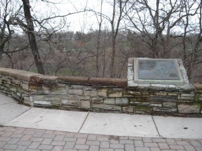
3. Main Entrance Minnehaha Lower Glen Marker
Another marker is no longer nearby. George Washington Bi-Centennial Tree (was about 400 feet away but has been confirmed missing).
More about this marker. Svenskarnas Dag (Swedish Day), mentioned in the marker, is the Midwest's oldest Midsummer festival, dating back to 1911.
Photographed by Keith L, October 16, 2008
4. Minnehaha Lower Glen
Credits. This page was last revised on March 1, 2026. It was originally submitted on March 10, 2011, by Keith L of Wisconsin Rapids, Wisconsin. This page has been viewed 1,631 times since then and 86 times this year. Photos: 1, 2. submitted on March 10, 2011, by Keith L of Wisconsin Rapids, Wisconsin. 3. submitted on May 21, 2011, by Keith L of Wisconsin Rapids, Wisconsin. 4. submitted on March 10, 2011, by Keith L of Wisconsin Rapids, Wisconsin.
