Near Calistoga in Napa County, California — The American West (Pacific Coastal)
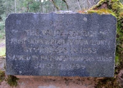
The White Church
The White Church
First church built in Napa County
by pioneers in 1853
Marked by Federated Womens Clubs
June 11, 1939
Erected 1939 by Federated Womens Clubs.
Topics. This historical marker is listed in this topic list: Churches & Religion. A significant historical month for this entry is June 1926.
Location. 38° 32.949′ N, 122° 30.82′ W. Marker is near Calistoga, California, in Napa County. Marker can be reached from State Highway 29, 0.7 miles south of Larkmead Lane. Touch for map. Marker is in this post office area: Calistoga CA 94515, United States of America. Touch for directions.
Other nearby markers. At least 8 other markers are within 3 miles of this marker, measured as the crow flies. Reason P. Tucker (approx. 0.6 miles away); Bale Grist Mill (approx. 0.6 miles away); Dr. Edward Turner Bale (approx. 0.7 miles away); Larkmead Winery / Kornell Cellars (approx. 0.8 miles away); Schramsberg (approx. one mile away); Charles Krug 1825 - 1892 (approx. 2.6 miles away); Charles Krug Winery (approx. 2.6 miles away); Cesare Mondavi 1883 – 1959 (approx. 2.6 miles away). Touch for a list and map of all markers in Calistoga.
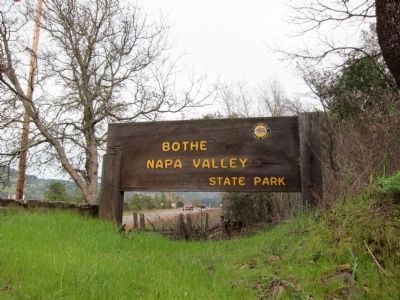
Also see . . . Bothe Napa Valley State Park. California Department of Parks and Recreation's web page for Both Napa Valley State Mark. Minimal historical content, however. (Submitted on March 11, 2011.)
Photographed By Andrew Ruppenstein, March 4, 2011
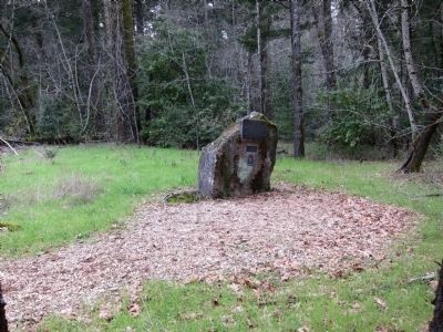
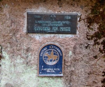
2. Additional markers mounted below The White Church Marker
Mounted on the same rock below the main marker are two additional markers. One is a centennial marker, reading "A Methodist Church named for its founder - Reverend Asa White". And below that is an additional marker reading, "United Methodist Historic Site No. 170".
Photographed By Andrew Ruppenstein, March 4, 2011
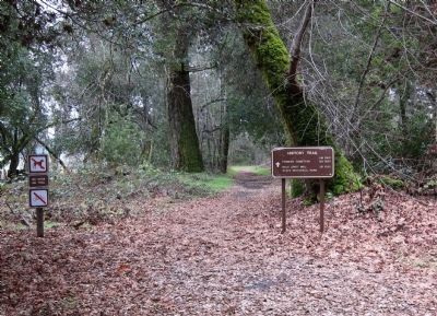
4. How to reach this marker.....
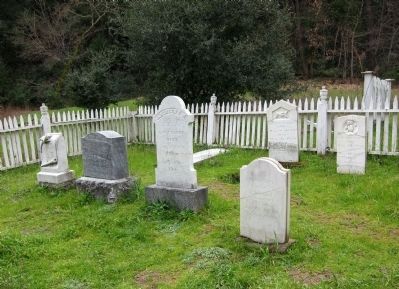
From the park entrance kiosk (there is an entrance fee), keep driving straight (south) as far as one can go and park. The trailhead and sign (pictured above) for the History Trail should be visible. Follow the path for a few hundred feet, and arrive at a large clearing, which once held the church and its cemetery. The marker is at the north end of the clearing, and the cemetery lies a bit further south. The church itself is no longer extant.
Credits. This page was last revised on June 16, 2016. It was originally submitted on March 11, 2011, by Andrew Ruppenstein of Lamorinda, California. This page has been viewed 1,034 times since then and 62 times this year. Last updated on March 13, 2011, by Andrew Ruppenstein of Lamorinda, California. Photos: 1, 2, 3, 4, 5, 6. submitted on March 11, 2011, by Andrew Ruppenstein of Lamorinda, California. • Syd Whittle was the editor who published this page.
