Lawrenceville in Pittsburgh in Allegheny County, Pennsylvania — The American Northeast (Mid-Atlantic)
Shannopin Town
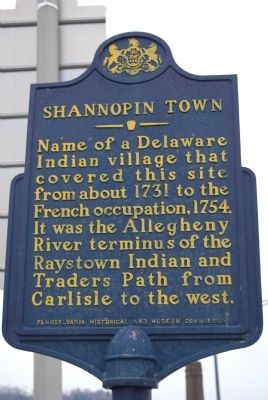
Photographed by Mike Wintermantel, March 13, 2011
1. Shannopin Town Marker
Erected 1958 by Pennsylvania Historical and Museum Commission.
Topics and series. This historical marker is listed in these topic lists: Indigenous Peoples and Communities • Settlements & Settlers. In addition, it is included in the Pennsylvania Historical and Museum Commission (PHMC) series list. A significant historical year for this entry is 1731.
Location. 40° 28.181′ N, 79° 57.819′ W. Marker is in Pittsburgh, Pennsylvania, in Allegheny County. It is in Lawrenceville. It is at the intersection of 40th Street and Foster Street, on the left when traveling north on 40th Street. Located at the southwest side of the 40th Street Bridge in Lawrenceville section of Pittsburgh. Touch for map. Marker is in this post office area: Pittsburgh PA 15201, United States of America. Touch for directions.

Regionally, this marker is in the American Northeast, in the Mid-Atlantic, in the Ohio River Valley, in Appalachia, and specifically in Northern Appalachia. Globally, it is in North America, the Western Hemisphere, the Western World, and the Anglosphere. Historically, it finds itself in what was once the Viceroyalty of New France, the Haudenosaunee (Iroquois) Confederacy, and one of the original Thirteen Colonies.
Other nearby markers. At least 8 other markers are within walking distance of this marker: December 30, 1753 (within shouting distance of this marker); Johnny Unitas (about 600 feet away, measured in a direct line); Allegheny Arsenal (approx. ¼ mile away); a different marker also named Allegheny Arsenal (approx. ¼ mile away); Soldiers and Sailors of the War of 1812 (approx. ¼ mile away);
this page online
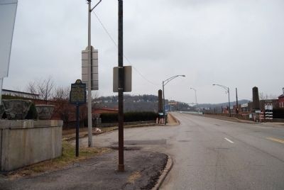
Photographed by Mike Wintermantel, March 13, 2011
2. Shannopin Town Marker
Looking north towards the 40th Street Bridge
Credits. This page was last revised on February 2, 2023. It was originally submitted on March 14, 2011, by Mike Wintermantel of Pittsburgh, Pennsylvania. This page has been viewed 3,752 times since then and 145 times this year. Photos: 1, 2. submitted on March 14, 2011, by Mike Wintermantel of Pittsburgh, Pennsylvania. • Bernard Fisher was the editor who published this page.
