Hilton Head Island in Beaufort County, South Carolina — The American South (South Atlantic)
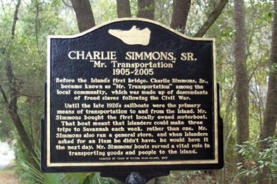
Charlie Simmons, Sr.
"Mr. Transportation"
1905~2005
Until the late 1920's sailboats were the primary means of transportation to and from the Island. Mr. Simmons bought the first locally owned motorboat. That boat meant that Islanders could make three trips to Savannah each week, rather than one. Mr. Simmons also ran a general store, and when Islanders asked for an item he didn't have, he would have it the next day. Mr. Simmons' boats served a vital role in transporting goods and people to the Island.
Erected 2010 by Town of Hilton Head Island.
Topics. This historical marker is listed in these topic lists: Industry & Commerce • Waterways & Vessels.
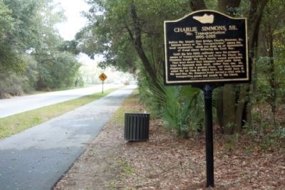
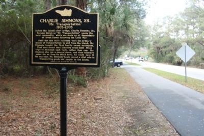
Location. 32° 12.795′ N, 80° 44.823′ W. Marker is on Hilton Head Island, South Carolina, in Beaufort County. Marker is on Spanish Wells Road, on the right when traveling south. Located approx. 500 feet south of William Hilton Parkway US 278. Touch for map. Marker is in this post office area: Hilton Head Island SC 29926, United States of America. Touch for directions.
Other nearby markers. At least 8 other markers are within 3 miles of this marker, measured as the crow flies. William Simmons House (approx. one mile away); Hilton Head Island Veterans Memorial (approx. 2.4 miles away); Pinckney Island (approx. 2˝ miles away); Charles Cotesworth Pinckney (approx. 2˝ miles away); First African Baptist Church (approx. 2˝ miles away); a different marker also named First African Baptist Church (approx. 2˝ miles away); World’s Largest Figurative Sundial (approx. 2˝ miles away); In Memoriam (approx. 2.9 miles away). Touch for a list and map of all markers in Hilton Head Island.
Credits. This page was last revised on October 18, 2020. It was originally submitted on March 21, 2011, by Mike Stroud of Bluffton, South Carolina. This page has been viewed 1,348 times since then and 41 times this year. Photos: 1, 2, 3, 4. submitted on March 21, 2011, by Mike Stroud of Bluffton, South Carolina.


