Pinnacles National Monument in San Benito County, California — The American West (Pacific Coastal)
Return to Condor Crags
Photographed by William Fischer, Jr., March 20, 2011
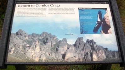
1. Return to Condor Crags Marker
The rocky spires of Condor Crags are seen rising above you, named by those who once saw California condors soaring over these lofty formations. In 2003, Pinnacles National Monument became part of a cooperative program to restore these endangered birds back to their wild, ancestral home. The program's goal is to reestablish a wild, self-sustaining population of condors.
The high rocks of Pinnacles National Monument were historically used as nest and roost sites for condors. As the recovery program increases the number of wild-living condors, these rocky areas will once again be home to this huge soaring bird.
Erected by National Park Service.
Topics. This historical marker is listed in these topic lists: Animals • Environment. A significant historical year for this entry is 2003.
Location. 36° 29.499′ N, 121° 12.532′ W. Marker is in Pinnacles National Monument, California, in San Benito County. It can be reached from California 146. Marker is about 300 feet NNE of the Chaparral Ranger Station, in the west Pinnacles, off California Route 146. Touch for map. Marker is in this post office area: Paicines CA 95043,
this page online

Regionally, this marker is on the Central Coast and specifically on the Coast Ranges. It is also on the American Pacific Coast. Globally, it is in North America, on the Ring of Fire, in the Pacific Rim, in the Western Hemisphere, in the Western World, and in the Anglosphere. Historically, it finds itself in what was once New Spain and also Mexico’s Alta California.
Other nearby markers. At least 8 other markers are within 11 miles of this marker, measured as the crow flies: Climbing at Pinnacles National Monument (about 300 feet away, measured in a direct line); One Voice Murals Project (approx. 8 miles away); Cesar Chavez Park (approx. 8.1 miles away); Railroad Station Site (approx. 8.1 miles away); Mission Nuestra Señora Dolorosísima de la Soledad (approx. 10 miles away); Padre Florencio Ibanez (approx. 10.1 miles away); Jose Joaquin de Arrillaga (approx. 10.1 miles away); The De Anza Expedition in Soledad (approx. 10.1 miles away).
Another marker is no longer nearby. Los Coches Rancho (was approx. 8.6 miles away but has been confirmed missing).
Also see . . . Pinnacles National Monument.
Photographed by William Fischer, Jr., March 20, 2011
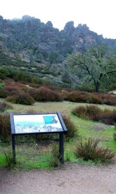
2. Return to Condor Crags Marker
Crags in background
Photographed by William Fischer, Jr., March 20, 2011
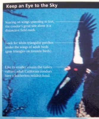
3. Return to Condor Crags Marker Detail
Photographed by William Fischer, Jr., March 20, 2011
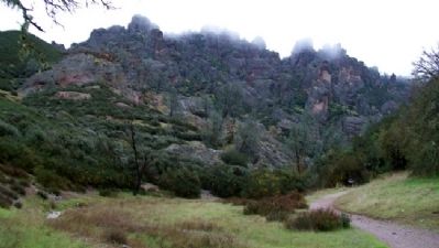
4. Cloud-covered Condor Crags
Credits. This page was last revised on February 1, 2026. It was originally submitted on March 24, 2011, by William Fischer, Jr. of Reynoldsburg, Ohio. This page has been viewed 843 times since then and 15 times this year. Photos: 1, 2, 3, 4. submitted on March 24, 2011, by William Fischer, Jr. of Reynoldsburg, Ohio.
