Near Fredericksburg in Spotsylvania County, Virginia — The American South (Mid-Atlantic)
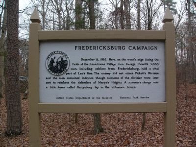
Fredericksburg Campaign
Erected by U.S. Department of the Interior, National Park Service.
Topics. This historical marker is listed in this topic list: War, US Civil. A significant historical date for this entry is December 13, 1862.
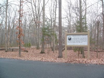
Location. 38° 16.24′ N, 77° 28.16′ W. Marker is near Fredericksburg, Virginia, in Spotsylvania County. Marker is on Lee Drive, on the right when traveling north. Marker is located along Lee Drive in the Fredericksburg-Spotyslvania Military Park, near a picnic area pullout. Touch for map. Marker is in this post office area: Fredericksburg VA 22408, United States of America. Touch for directions.
Other nearby markers. At least 8 other markers are within one mile of this marker, measured as the crow flies. Confederate Artillery Defense (approx. 0.6 miles away); Big Gun at Howison Hill (approx. 0.6 miles away); Braehead (approx. 0.8 miles away); a different marker also named Fredericksburg Campaign (approx. 0.9 miles away); Lee’s Hill (approx. one mile away); The Pioneers (approx. 1.1 miles away); The Second Battle of Fredericksburg (approx. 1.1 miles away); Artillery on Lee's Hill (approx. 1.1 miles away). Touch for a list and map of all markers in Fredericksburg.
Also see . . . Howison Hill Virtual Tour. National Park Service page. (Submitted on July 5, 2008, by Craig Swain of Leesburg, Virginia.)
Additional commentary.
1. Smaller Map Marker
A photo of the smaller map marker can be found at Civil War Album (link 2 above). The description on the map read:
About 3:30 P.M.
December 13, 1862
To the south, Stonewall Jackson's lines had been broken but were now restored. Here in the Lansdowne Valley, a minor Federal attack up Deep Run was soon repulsed.
— Submitted December 25, 2008, by Craig Swain of Leesburg, Virginia.
Credits. This page was last revised on February 20, 2023. It was originally submitted on December 11, 2007, by Kevin W. of Stafford, Virginia. This page has been viewed 1,097 times since then and 6 times this year. Photos: 1, 2, 3, 4. submitted on December 11, 2007, by Kevin W. of Stafford, Virginia.


