Kanab in Kane County, Utah — The American Mountains (Southwest)
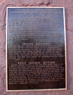
Exploration and Colonization
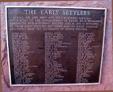
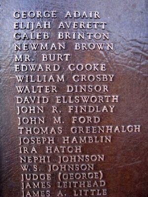
The Early Settlers
Evidence of the Anasazi's footsteps across the high plateaus of the area date back 2000 years. They were cliff dwellers who hunted deer and mountain sheep, and farmed the land. The Anasazi reached the peak of their culture from about 700 A.D. to 1000 A.D. In 1300 A.D., they abandoned their homes and moved southward. The cause of their departure is unclear, but it is believed that a severe drought or invasion by the Navajos precipitated their move out of the area.
After the Anasazi disappeared, the area was criss-crossed by nomadic tribes of Paiute and Navajo Indians. The Kaibab Band of Paiutes & the Navajo continue to live here and contribute to our cultural heritage.
In 1776, the first Europeans led by Father Escalante and Father Dominguez, explored this area seeking a route from Santa Fe, New Mexico to California. At that time the region was Spanish territory that later passed to Mexico. As a result of the war with Mexico in 1846, the territory became part of the United States in the 1848 Treaty of Guadelupe Hidalgo. The old Spanish trails of that time later became the foundations for the highways of today.
Mormon pioneers settled in the Salt Lake Valley, Utah, in 1847. Within a few years, many new settlements were established as the region was explored. Jacob Hamblin, a frontiersman and Indian missionary, was instrumental in the settlement of the Kanab area. Under the direction of Hamblin, construction of Fort Kanab was started in 1864 to provide a base for exploration & protection from Indian attacks. Frequent Indian attacks made it impractical to maintain the fort and it was abandoned in 1866. Fort Kanab was then periodically occupied until June 14, 1870, when the party of settlers under the leadership of Levi Stewart arrived to establish a permanent settlement.
——————
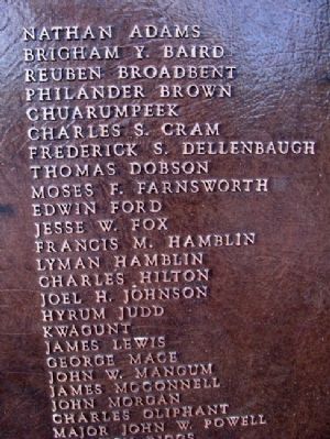
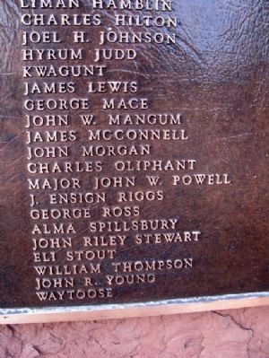
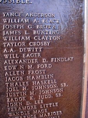
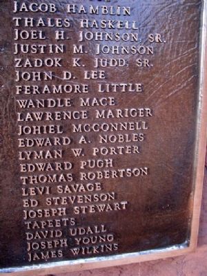
During the late 1860's and 1870's numerous settlers contributed to the establishment of Kanab as a permanent community. This monument erected June 14, 2001 is dedicated to those early settlers and their families whose courage and vision made the settlement of Kanab possible.
Erected 2001.
Topics and series. This historical marker is listed in these topic lists: Hispanic Americans • Native Americans • Settlements & Settlers • War, Mexican-American. In addition, it is included in the Old Spanish National Trail series list. A significant historical date for this entry is June 14, 1943.
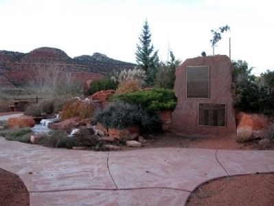
Location. 37° 2.96′ N, 112° 32.114′ W. Marker is in Kanab, Utah, in Kane County. The marker is in Levi Stewart Memorial Park, on North 300 West (US Route 89). Touch for map. Marker is in this post office area: Kanab UT 84741, United States of America. Touch for directions.
Other nearby markers. At least 8 other markers are within walking distance of this marker. A Tragedy (a few steps from this marker); Fort Kanab (a few steps from this marker); Dale Evans (within shouting distance of this marker); Jacob Hamblin (within shouting distance of this marker); Penny Edwards (within shouting distance of this marker); Fay Hamblin (within shouting distance of this marker); Jim Davis (within shouting distance of this marker); Brian Keith (about 300 feet away, measured in a direct line). Touch for a list and map of all markers in Kanab.
Regarding Exploration and Colonization. The word 'Guadalupe' is misspelled in the marker text as 'Guadelupe'.
Credits. This page was last revised on February 3, 2021. It was originally submitted on April 1, 2011, by William Fischer, Jr. of Scranton, Pennsylvania. This page has been viewed 855 times since then and 23 times this year. Photos: 1, 2, 3, 4, 5, 6, 7, 8, 9. submitted on April 1, 2011, by William Fischer, Jr. of Scranton, Pennsylvania.
