New Britain in Hartford County, Connecticut — The American Northeast (New England)
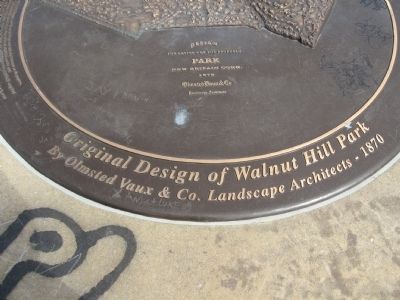
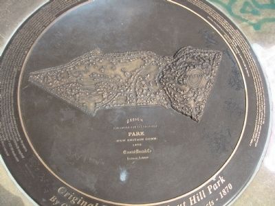
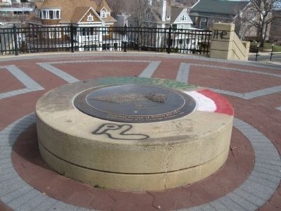
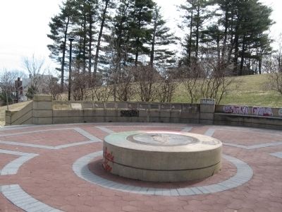
Original Design of Walnut Hill Park
By Olmstead Vaux & Co. Landscape Architects – 1870
On July 18, 1867 Frederick T. Stanley sent the following letter to Frederick Law Olmstead
Dear Sir:
A Public park is proposed to be laid out in our village on a very beautiful hill comprising some 36 acres now belonging to a company of individuals, who (purchased) it in 1856 for the purpose of locating the reservoir for the water works, ultimately to appropriate it for Public Grounds. A competent engineer is now surveying and measuring the area of ground and showing on his map the location of the reservoir and roadway leading to it. This hill, 150 feet higher than the village and as they are building all around it, will soon be in the center of the Borough. I would very much like to have you come and see it and advise us what plan to pursue in regard to it if you can spare the time. It will require two days time and I want you to spend the night with me as we can talk over the matter. The Co. are unwilling that any other plan but yours shall be entertained in regard to it. Will you be good enough to inform me whether it will be convenient to come and if so how soon as we would like to confirm this fact.
Very truly yours, F. T. Stanley
fountain given by CF Smith 1928 Rose Garden 1930 Rock Garden 1931 Steps and walk from West Main Street to monument completed. Design was by H. Van Buren Magonigle 1939 Darius Miller Music Shell 1940 Field House 1964 JFK Memorial 1970 Charles Hamilton Plaque 1976 Freedom Grove 1989 Human Rights Monument 1996 Walk for Life initiated 2001 Limestone steps and walk from West Main Street renovated
Topics. This historical marker is listed in these topic lists: Charity & Public Work • Environment. A significant historical month for this entry is July 1953.
Location. 41° 39.979′ N, 72° 47.213′ W. Marker is in New Britain, Connecticut, in Hartford County. Marker can be reached from the intersection of West Main Street and Cedar Street, on the left when traveling west. Located in Walnut Hill Park. Touch for map. Marker is in this post office area: New Britain CT 06052, United States of America. Touch for directions.
Other nearby markers. At least 8 other markers are within walking distance of this marker. Darius Miller (here, next to this marker); William B. Stanley (here, next to this marker); William A. Churchill (here, next to this marker); Elise Traut (here, next to this marker); George M. Landers (here, next to this marker); Frederick T. Stanley (here, next to this marker); Cornelius B. Erwin (here, next to this marker); Henry E. Russell (here, next to this marker). Touch for a list and map of all markers in New Britain.
Photographed By Michael Herrick, March 29, 2011
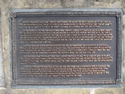
4. Adjacent Descriptive Marker
In 1857, the Walnut Hill Park Company transferred the reservoir and access roads to the town of New Britain without cost. The motivation of the shareholders of the Walnut Hill Park Company seem to have wanted to create a city with the finest cultural, educational, and civic institutions.
In the years 1857 to 1862, the Walnut Hill Park Company carried out drainage and road improvements on the property but progress was slow and Frederick Stanley was growing impatient with the town's failure to initiate development of the park. In June 1886, Stanley wrote in a letter to the editors of the New Britain Record that the war had been no excuse for the lack of progress and instead laid the blame on "the apathy of its citizens." Stanley later took matters into his own hands and contacted landscape architect - Frederick Law Olmstead.
Olmstead traveled to New Britain in August 1867 and recommended the acquisition of additional property to the west and southwest of Walnut Hill. The additional forty acres of land would provide some flat land for the park in addition to the hill. Stanley conferred with Cornelius Erwin who was enthusiastic and recommended acquiring the property while the cost was still low.
The following year the Walnut Hill Park Company proposed to sell its 36 acres of land to the town for a nominal price, provided that the town procure the additional land necessary to construct that park. The company would sell the town the land it had held since 1856 for approximately half of its value.
A special town meeting was held in January 1869, and there was a unanimous vote to purchase the land for a public park and to issue town bonds for $50,000 to pay for land and construction. Upon approval for this charter for a park and for the bonding by the state legislature, Henry Russell, Chairman of the Board of Park Commissioners requested that Stanley ask Olmstead to return to New Britain to view that land again and present a final plan for the park.
Credits. This page was last revised on June 16, 2016. It was originally submitted on April 2, 2011, by Michael Herrick of Southbury, Connecticut. This page has been viewed 1,328 times since then and 27 times this year. Photos: 1, 2, 3, 4, 5. submitted on April 2, 2011, by Michael Herrick of Southbury, Connecticut.
