Radford, Virginia — The American South (Mid-Atlantic)
Radford
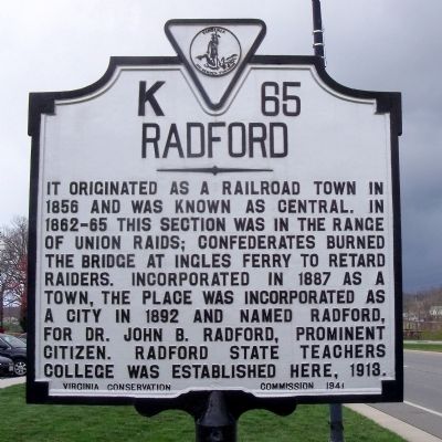
Photographed by Bernard Fisher, April 2, 2011
1. Radford Marker
Erected 1941 by Virginia Conservation Commission. (Marker Number K-65.)
Topics and series. This historical marker is listed in these topic lists: Education • Railroads & Streetcars • War, US Civil. In addition, it is included in the Virginia Department of Historic Resources (DHR) series list. A significant historical year for this entry is 1856.
Location. 37° 8.453′ N, 80° 33.078′ W. Marker is in Radford, Virginia. It is on East Main Street (U.S. 11) east of Tyler Avenue (Virginia Route 177), on the right when traveling north. Touch for map. Marker is at or near this postal address: 801 East Main Street, Radford VA 24142, United States of America. Touch for directions.

Regionally, this marker is in Southwest Virginia and in
this page online
Other nearby markers. At least 8 other markers are within walking distance of this marker: Lovely Mount Baptist Church (approx. 0.3 miles away); Wildwood Pool (approx. one mile away); Tree of Honor (approx. one mile away); Dedicated to the Patriots of the American Revolutionary War (approx. one mile away); Radford High Military Service (approx. one mile away); Viet-Nam War Veterans Memorial (approx. one mile away); To Honor All World War I Veterans (approx. one mile away); Service Tree (approx. one mile away). Touch for a list and map of all markers in Radford.
Also see . . .
1. Radford, Virginia. The New River City (Submitted on April 4, 2011.)
2. Radford, Virginia.

Photographed by Bernard Fisher, April 2, 2011
2. US Rt 11 (facing east)
3. Radford University. (Submitted on April 4, 2011.)
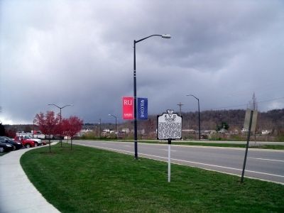
Photographed by Bernard Fisher, April 2, 2011
3. US Rt 11 (facing west)
Credits. This page was last revised on November 11, 2021. It was originally submitted on April 4, 2011, by Bernard Fisher of Richmond, Virginia. This page has been viewed 1,244 times since then and 34 times this year. Photos: 1, 2, 3. submitted on April 4, 2011, by Bernard Fisher of Richmond, Virginia.
