Blacksburg in Montgomery County, Virginia — The American South (Mid-Atlantic)
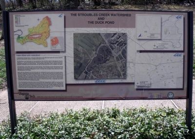
The Stroubles Creek Watershed and the Duck Pond
Inscription.
Learn about your watershed
A watershed or drainage basin, is the area of land where all the water that drains off it runs to a specific point on a watercourse, usually a confluence of stream or river.
The Stroubles Creek watershed is a sub-watershed of the New River basin in Montgomery County, Virginia. The surrounding area of Stroubles Creek is characterized by limestone/dolomite formations, sink holes, and natural springs. The streambed of Stroubles Creek is alluvium-flood-plain deposits of stratified unconsolidated sand, silt, and clay with beds and lenses of pebbles and cobles.
The headwaters of Stroubles Creek are natural springs. The freshwater stream discharges into the New River after flowing through urban and urbanizing areas of Blacksburg, Virginia Tech, and agricultural and rural areas of Montgomery County. The size of the Stroubles Creek watershed is about 6,393 hectares or 15,797 acres.
Major land use changes have occurred within the watershed during the past one-hundred years, primarily in residential and agricultural development. In 1900, the urban land use was insignificant; the town was a few square blocks, and the university consisted of a few buildings and experimental agricultural fields. From the mid 1800s to 1930s, deep coal mining was an active industry in the watershed. One event of significant ecological consequence occurred in 1937 when the natural course of the central branch of Stroubles Creek was altered and partially covered in order to accommodate building a drill field on the Virginia Tech campus. At about the same time, a small dam was built to expand the Duck Pond for recreational purposes.
Two main branches of Stroubles Creek, Webb Branch and Central Branch, feed into the Duck Pond. The springs of the two branches emerge from the northern part of the town of Blacksburg. Currently, the pond serves both as a recreational facility and as a stormwater management facility for urban runoff from the town of Blacksburg and parts of the university. A contour map showing the land elevation of the Duck Pond is provided on the lower right of this sign. The image on the center of this sign is an aerial photo of the Duck Pond taking in 1999.
Erected by Virginia Tech and Phi Sigma Pi.
Topics. This historical marker is listed in these topic lists: Education • Environment • Waterways & Vessels. A significant historical year for this entry is 1900.
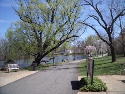
Location. 37° 13.51′ N, 80° 25.698′ W. Marker is in Blacksburg, Virginia, in Montgomery County. Marker can be reached from Duckpond Drive near Smithfield Road. This marker is located along the south bank of the Duck Pond on Virginia Tech's campus. Touch for map. Marker is in this post office area: Blacksburg VA 24061, United States of America. Touch for directions.
Other nearby markers. At least 8 other markers are within walking distance of this marker. Enslaved People and the Prestons / From Plantation to College Campus (about 600 feet away, measured in a direct line); Native Stewardship / The Monacan Peoples (approx. 0.2 miles away); Solitude (approx. 0.2 miles away); Mary Draper Ingels (approx. 0.2 miles away); Robert James Davidson (approx. 0.2 miles away); Thomas Marshall Hahn Jr. (approx. ¼ mile away); Harvey Lee Price (approx. ¼ mile away); Frank Leigh Robeson (approx. ¼ mile away). Touch for a list and map of all markers in Blacksburg.
Also see . . . Stroubles Creek Site. National Register of Historic Places (Submitted on November 10, 2021.)
Credits. This page was last revised on July 16, 2023. It was originally submitted on April 5, 2011, by Bernard Fisher of Richmond, Virginia. This page has been viewed 1,312 times since then and 106 times this year. Photos: 1, 2. submitted on April 5, 2011, by Bernard Fisher of Richmond, Virginia.

