Manassas, Virginia — The American South (Mid-Atlantic)
Mayfield Civil War Fort
Manning the Fort
— The Manassas Museum System —
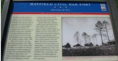
The life of Civil War soldiers in camp was one of boredom, fear, mischief, disease and even death. Thousands of young men, many of whom had never before left their family farms or urban neighborhoods, were crowded into the makeshift camps. Disease could run rampant, and sanitary conditions were often inadequate. Most men lived in tents year-round, though the Confederates built crude wooden huts during the winter of 1861-1862.
Much of the soldier's day was spent learning military drill. They also searched for clean water, mended clothes, dug trenches for latrines, and gathered wood for cooking and heating. The men subsisted mostly on salt pork, dried beans, corn bread, and hardtack (a dense cracker baked to the consistency of wood). At times soldiers received food sent from home. By far, the most important staple was coffee.
Despite their heavy workload, soldiers always had time for recreation. Almost every unit had at least one boy who could strum a guitar or banjo, or play a fiddle. The soldiers also read, wrote letters to their loved ones, partook in religious reflection, and played any game they could devise, including baseball, cards, boxing matches, and cockfights. They bet on anything that would move, from lice dropped onto heated plates, to pushing comrades seated in wheelbarrows. They used cannon balls for bowling at ten-pins, whittled sticks, carved pipes from soapstone, and talked about the nature of war and the hope of returning home.
Erected by Virginia Civil War Trails.
Topics and series. This historical marker is listed in this topic list: War, US Civil. In addition, it is included in the Virginia Civil War Trails series list.
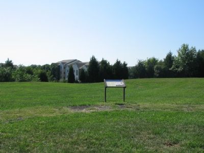
Location. This marker has been replaced by another marker nearby. It was located near 38° 45.227′ N, 77° 27.156′ W. Marker was in Manassas, Virginia. Marker could be reached from the intersection of Battery Heights Boulevard and Quarry Road, on the right when traveling south. Located inside the earthworks at Mayfield Civil War Fort Park. Touch for map. Marker was in this post office area: Manassas VA 20110, United States of America. Touch for directions.
Other nearby markers. At least 8 other markers are within walking distance of this location. Battle of Bull Run Bridge (here, next to this marker); a different marker also named Battle of Bull Run Bridge (here, next to this marker); Casualties of Battle (here, next to this marker); Role of Mayfield in Battle of First Manassas (a few steps from this marker); Preservation of Mayfield Fort (a few steps from this marker); Building the Fort System
(a few steps from this marker); Why the Forts? (a few steps from this marker); Camps of Instruction (a few steps from this marker). Touch for a list and map of all markers in Manassas.
More about this marker. On the left, “An 1862 photograph of winter quarters of Confederate forces thought to be located southwest of Mayfield plantation near Manassas Junction.”
Related markers. Click here for a list of markers that are related to this marker. To better understand the relationship, study each marker in the order shown.
Also see . . .
1. Mayfield Fort – A Civil Work Earthwork Fortification. (Submitted on September 10, 2007, by Craig Swain of Leesburg, Virginia.)
2. How the Civil War Soldiers Lived. (Submitted on September 10, 2007, by Craig Swain of Leesburg, Virginia.)
3. What was life as a soldier like in 1863?. (Submitted on September 10, 2007, by Craig Swain of Leesburg, Virginia.)
4. Hardtack. Yummy! (Submitted on September 10, 2007, by Craig Swain of Leesburg, Virginia.)
5. Civil War Baseball: Baseball and the Blue and the Gray. (Submitted on September 10, 2007, by Craig Swain of Leesburg, Virginia.)
Credits. This page was last revised on January 8, 2023. It was originally submitted on September 10, 2007, by Craig Swain of Leesburg, Virginia. This page has been viewed 1,888 times since then and 17 times this year. Last updated on April 7, 2011, by Jonathan Carruthers of Bealeton, Virginia. Photos: 1, 2, 3. submitted on September 10, 2007, by Craig Swain of Leesburg, Virginia.


