Near Macon in Jones County, Georgia — The American South (South Atlantic)
Battle of Griswoldville
Photographed by David Seibert, April 1, 2011
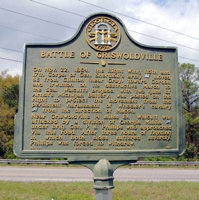
1. Battle of Griswoldville Marker
Near Griswoldville (4 miles E), Walcutt was attacked by a division of Georgia Militia [CS] under Brig. Gen. P. J. Phillips who approached via this road. After three hours of fighting in which both sides suffered severely, Phillips was forced to withdraw.
Erected 1957 by Georgia Historical Commission. (Marker Number 084-21.)
Topics and series. This historical marker is listed in this topic list: War, US Civil. In addition, it is included in the Georgia Historical Society, and the Sherman’s March to the Sea series lists. A significant historical month for this entry is October 1934.
Location. 32° 52.433′ N, 83° 33.317′ W. Marker is near Macon, Georgia, in Jones County. It is at the intersection of Old Garrison Road (Georgia Route 49) and Griswoldville Road,
this page online

Regionally, this marker is in the Antebellum Trail and in the Piedmont. It is also in the American South and specifically in the Deep South. Globally, it is in North America, the Western Hemisphere, the Western World, and the Anglosphere. Historically, it finds itself in what was once the territory of the Mississippian Culture, one of the original Thirteen Colonies, one of the Confederate States of America, and the Antebellum South.
Other nearby markers. At least 8 other markers are within 4 miles of this marker, measured as the crow flies: A different marker also named Battle of Griswoldville (approx. 3.2 miles away); The Dunlap House (approx. 3.4 miles away); Railroad Overpass (approx. 3.4 miles away); William Bartram Trail (approx. 3½ miles away); Battles of Dunlap Farm (approx. 3½ miles away); a different marker also named The Dunlap House (approx. 3½ miles away); The Battle of Dunlap Hill-Stoneman's Raid
Photographed by David Seibert, April 1, 2011
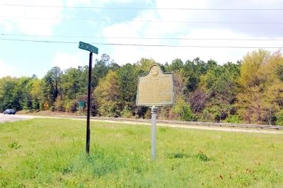
2. Battle of Griswoldville Marker
Photographed by David Seibert, April 1, 2011
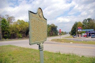
3. Battle of Griswoldville Marker
Looking northeast on Old Garrison Road, Georgia Highway 49
Photographed by David Seibert, April 1, 2011
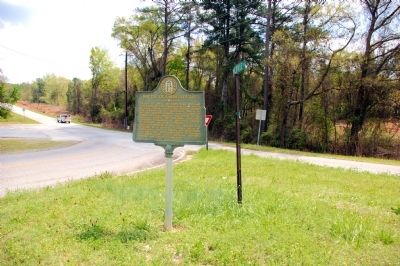
4. Battle of Griswoldville Marker
Looking southwest on Old Garrison Road (Georgia Highway 49) toward Macon
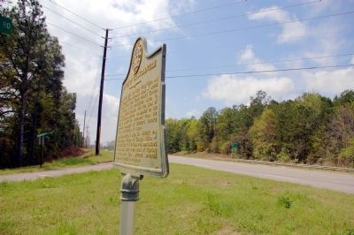
Photographed by David Seibert, April 1, 2011
5. Battle of Griswoldville Marker
Bent but not broken; something has hit the marker.
Credits. This page was last revised on June 16, 2016. It was originally submitted on April 8, 2011, by David Seibert of Sandy Springs, Georgia. This page has been viewed 947 times since then and 22 times this year. Photos: 1, 2, 3, 4, 5. submitted on April 8, 2011, by David Seibert of Sandy Springs, Georgia. • Craig Swain was the editor who published this page.
