Charles Town in Jefferson County, West Virginia — The American South (Appalachia)
Rutherford House
“Go in!”
— 1864 Valley Campaign —
The Federal offensive in the Shenandoah Valley begun in May 1864 faltered in the summer with Confederate victories and Gen. Jubal A. Early's Washington Raid in July. Union General Philip H. Sheridan took command in August, defeated Early at Winchester in September and Cedar Creek in October, burned mills and barns, and crushed the remnants of Early’s force at Waynesboro on March 2, 1865. Sheridan’s victories contributed to President Abraham Lincoln’s reelection in November 1864 and denied Gen. Robert E. Lee’s army much needed provisions from the “Breadbasket of the Confederacy.”
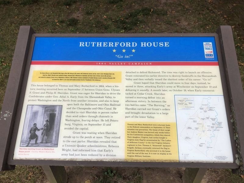
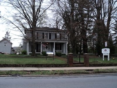
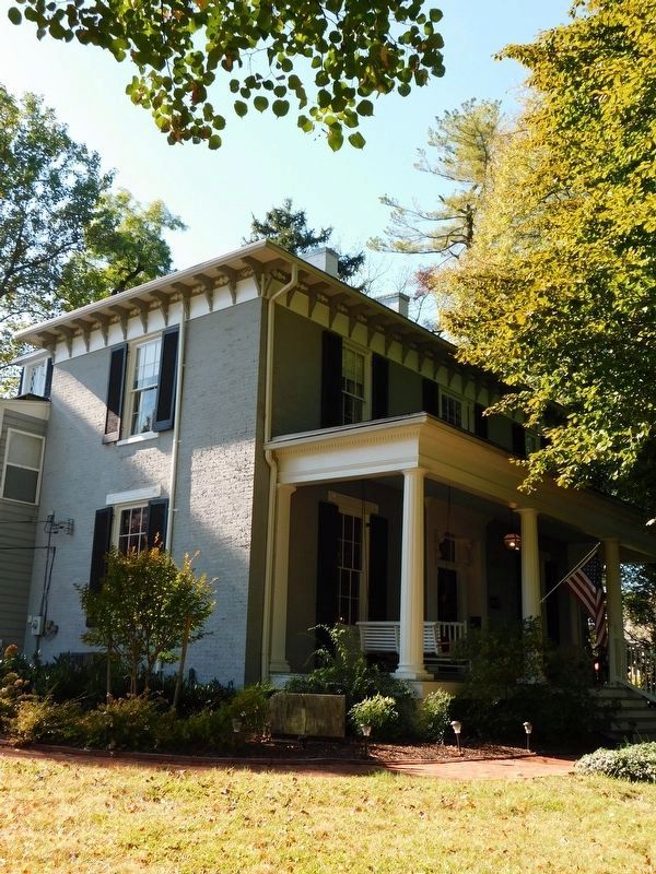
This house belonged to Thomas and Mary Rutherford in 1864, when a historic meeting occurred here on September 17 between Union Gens. Ulysses S. Grant and Philip H. Sheridan. Grant was eager for Sheridan to drive the Confederates under Gen. Jubal A. Early from the Shenandoah Valley, to protect Washington and the North from another invasion, and also to keep open both the Baltimore and Ohio Railroad and the Chesapeake and Ohio Canal. He decided to visit Sheridan in person rather than send orders through channels in Washington, fearing delays. He left Petersburg, Virginia, on September 15 and avoided the capital.
Grant was waiting when Sheridan strode up to the porch at noon. They retired to the east parlor. Sheridan revealed that a Unionist Quaker schoolmistress, Rebecca Wright, had informed him that Early’s army had just been reduced by a division detached to defend Richmond. The time was right to launch an offensive. Grant reiterated his earlier directive to destroy foodstuffs in the Shenandoah Valley and then verbally issued the shortest order of his career: “Go in!”
Grant hoped that Sheridan could move in four days; instead, he moved in three, attacking Early’s army at Winchester on September 19 and defeating it soundly. A month later, on October 19, when Early counterattacked at Cedar Creek, Sheridan turned a morning defeat into an afternoon victory. In between the two battles came “The Burning,” as Sheridan carried out Grant’s orders and brought devastation to a large part of the lower Valley.
Thomas and Mary Rutherford were reluctant hosts to the Federal commanders on September 17. Their situation was precarious. The house of their neighbor Andrew Hunter was burned only weeks before for his Confederate sympathies, which they shared. Their daughter, Virginia, had earlier bought a Virginia state flag for presentation by "The Ladies of Jefferson County" to the 2nd Virginia Infantry regiment in Gen. Thomas J. "Stonewall" Jackson’s brigade. Jackson eventually returned the flag to Virginia Rutherford, who secreted it in the house until the end of the war. It is now on display at the Virginia Military Institute.
Erected by West Virginia Civil War Trails.
Topics and series. This historical marker is listed in this topic list: War, US Civil. In addition, it is included in the Chesapeake and Ohio (C&O) Canal, and the West Virginia Civil War Trails series lists. A significant historical month for this entry is March 1863.
Location. 39° 17.435′ N, 77° 51.307′ W. Marker is in Charles Town, West Virginia, in Jefferson County. Marker is at the intersection of E Washington Street (U.S. 340 Bus) and S Seminary Street, on the right when traveling east on E Washington Street. Touch for map. Marker is at or near this postal address: 417 E Washington Street, Charles Town WV 25414, United States of America. Touch for directions.
Other nearby markers. At least 8 other markers are within walking distance of this marker. The Stribling House (a few steps from this marker); Lock Graveyard Memorial (about 300 feet away, measured in a direct line); The Flagg House (about 300 feet away); The Confederate Dead (about 400 feet away); Edge Hill Cemetery (about 400 feet away); In Memoriam (about 400 feet away); Zion Episcopal Churchyard (about 500 feet away); "Coloured" Grave Yard (about 600 feet away). Touch for a list and map of all markers in Charles Town.
More about this marker. The bottom left of the marker features a picture of “Sheridan meeting Grant on Rutherford House porch. - Courtesy Western Reserve Historical Society.”
The right side of the marker contains a map which highlights significant Civil War Sites in Jefferson County, WV, many of which are interpreted by Civil War Trail signage.
Additional commentary.
1. Illustration of Sheridan meeting Grant on marker.
The illustration on the bottom left was done by James E. Taylor, one of the leading nineteenth-century illustrators of the American West. Working for Frank Leslie’s Illustrated Newspaper he traveled with the Union Army in Virginia, West Virginia, South Carolina, and North Carolina focusing particularly on panoramas of battles and the settings of the war.
— Submitted November 7, 2020, by Mark Hilton of Montgomery, Alabama.
Credits. This page was last revised on January 6, 2024. It was originally submitted on April 12, 2011, by Bill Coughlin of Woodland Park, New Jersey. This page has been viewed 1,569 times since then and 72 times this year. Last updated on January 4, 2024, by Carl Gordon Moore Jr. of North East, Maryland. Photos: 1. submitted on October 11, 2020, by Devry Becker Jones of Washington, District of Columbia. 2. submitted on April 12, 2011, by Bill Coughlin of Woodland Park, New Jersey. 3. submitted on April 5, 2021, by Bradley Owen of Morgantown, West Virginia. • J. Makali Bruton was the editor who published this page.


