Fishers Hill in Shenandoah County, Virginia — The American South (Mid-Atlantic)
Fisher's Hill
Union Flank Attack
— 1864 Valley Campaign —
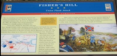
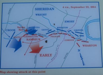
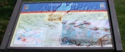
Union Gen. Philip H. Sheridan had sent Gen. George Crook's corps sweeping around Early's left flank that morning, and around 4 p.m. Crook's men overwhelmed Confederate Gen. Lunsford L. Lomax's cavalrymen at the foot of Little North Mountain to your left. The Federals then swept on to this point, where Confederate Gen. Stephen D. Ramseur's infantrymen held firm to buy time for the rest of Early's line to retreat. They also faced an attack from the north (your front) by Gen. James B. Rickett's division, while other Federal units pressed the Confederate forces to your right.
Here, and in nearby earthworks, occurred the heaviest fighting of the Battle of Fisher's Hill. Ramseur sent Gen. Cullen Battle's Alabama Brigade to strengthen the Confederate line. Battle staked his position with a cedar stick, threatening any man who thought of running.
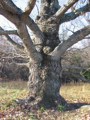
(Sidebar): To your left is a "lookout" tree in which Confederate observers erected a platform after trimming branches and the top of the trunk. Scars from these modifications are still visible. (caption)
(lower left) Map showing the point of the Federal attack (right)Painting of battle from Confederate position
Erected by Virginia Civil War Trails.
Topics and series. This historical marker is listed in this topic list: War, US Civil. In addition, it is included in the Virginia Civil War Trails series list. A significant historical date for this entry is September 2, 1864.
Location. This marker has been replaced by another marker nearby. 38° 59.281′ N, 78° 25.222′ W. Marker is in Fishers Hill, Virginia, in Shenandoah County. Marker can be reached from Battlefield Road (County Route 601), on the right when traveling east. Located on top of Fisher's Hill within the Civil War Preservation Trust Fisher's Hill Battlefield site. Touch for map. Marker is at or near this postal address: 601 Battlefield Rd, Fishers Hill VA 22626, United States of America. Touch for directions.
Other nearby markers. At least 8 other markers are within walking distance of this location. A different marker also named Fisher’s Hill (here, next to this marker); a different marker also named Fisher’s Hill (within shouting distance of this marker); a different marker also named Fisher’s Hill (about 300 feet away, measured in a direct line); a different marker also named Fisher’s Hill (about 500 feet away); a different marker also named Fisher’s Hill (about 500 feet away); a different marker also named Fisher’s Hill (about 600 feet away); a different marker also named Fisher’s Hill (about 800 feet away); Battle of Fisher’s Hill (approx. 0.2 miles away). Touch for a list and map of all markers in Fishers Hill.
More about this marker. This marker was replaced by a new one named Fisher’s Hill - Ramseur and Grimes Disagree (see nearby markers).
Regarding Fisher's Hill. This is one of several markers interpreting the Battle of Fisher's Hill. See the Battle of Fisher's Hill Virtual Tour by Markers linked below.
Related marker. Click here for another marker that is related to this marker. New Marker At This Location also titled "Fisher's Hill".
Also see . . . Battle of Fisher's Hill. National Park Service summary of the battle. (Submitted on December 12, 2007, by Craig Swain of Leesburg, Virginia.)
Photographed By Craig Swain, December 1, 2007
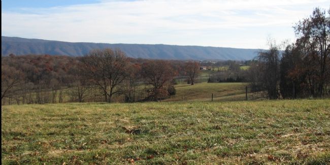
6. Looking South from the Crest of Fisher's Hill
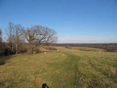
Brig. Gen. Cullen Battle's Alabama Brigade was posted in this vicinity to check the Federal flanking attacks. While this stopped the first wave of Federal attacks, Division Commander General Ramseur realized the need to extend the lines and ordered a North Carolina brigade under Brig. Gen. William R. Cox to move there. Cox's brigade ended up marching to the wrong location and thus left the Confederate flank exposed.
Credits. This page was last revised on November 14, 2021. It was originally submitted on December 12, 2007, by Craig Swain of Leesburg, Virginia. This page has been viewed 1,832 times since then and 31 times this year. Photos: 1, 2. submitted on December 12, 2007, by Craig Swain of Leesburg, Virginia. 3. submitted on October 9, 2012, by David Graff of Halifax, Nova Scotia. 4, 5. submitted on December 12, 2007, by Craig Swain of Leesburg, Virginia. 6. submitted on December 16, 2007, by Craig Swain of Leesburg, Virginia.
