McCormick in McCormick County, South Carolina — The American South (South Atlantic)
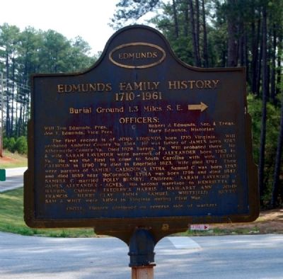
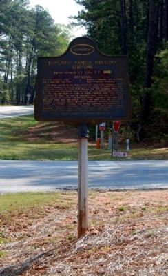
Edmunds Family History
⎯⎯⎯
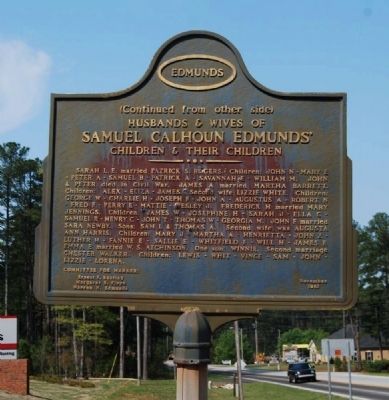
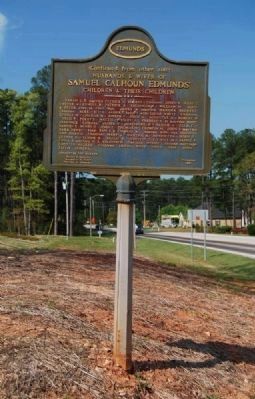
Samuel Calhoun Edmunds
Photographed by Brian Scott, April 11, 2011
1. Edmunds Family History Marker (obverse)
(obverse)
1710-1961
Burial Ground 1.3 Miles S.E. —›
Officers:
Joe F. Edmunds, Vice Pres.
Robert J. Edmunds, Sec. & Treas.
Mary Edmunds, Historian
The first record is of John Edmunds, born 1710 Virginia. Will probated Amherst County Va. 1764. He was father of James born 1743 Albermarle County Va. Died 1826 Barren, Ky. Will probated there. He & his wife Sarah Lavender were parents of Alexander born 1763 in Va. He was the first to come to South Carolina with wife Lydia Calhoun in 1790. He died in Edgefield 1823. Wife died 1797. They were parents of Samuel Calhoun & Lydia. Samuel C was born 1793 and died 1859 near McCormick. Lydia was born 1796 and died 1847. Samuel C married Polly Bussey. Children: Sarah Lavender - James Alexander - Agnes. His second marriage to Henrietta R. Harris. Children: Frederick Harris - Margaret Ann - John Francis - Henry Clay - Emma - Samuel - Whitefield - Betty. Sam & Whit were killed in Virginia during the Civil War.
Husbands & Wives of
Samuel Calhoun Edmunds'
Children
this page online
———— ••• ————
Committee for Marker
Ernest F. Bentley
Margaret E. Floyd
Warren N. Edmunds
Erected 1961 by Edmunds Family History Association.
Topics. This historical marker is listed in these topic lists: Cemeteries & Burial Sites • Settlements & Settlers. A significant historical year for this entry is 1710.
Location. 33° 52.269′ N,
Photographed by Brian Scott, April 11, 2011
2. Samuel Calhoun Edmunds Marker (reverse)

Regionally, this marker is in Upstate. It is also in the American South and specifically in the Deep South. Globally, it is in North America, the Western Hemisphere, the Western World, and the Anglosphere. Historically, it finds itself in what was once the territory of the Mississippian Culture, one of the original Thirteen Colonies, one of the Confederate States of America, and the Antebellum South.
Other nearby markers. At least 10 other markers are within 5 miles of this marker, measured as the crow flies: Welcome to Baker Creek State Park (approx. 1.4 miles away); General Elijah Clark (approx. 1.9 miles away in Georgia); Dooly Spring (approx. 2 miles away in Georgia); Tory Pond (approx. 2.8 miles away in Georgia); The Guillebeau House (approx. 3.1 miles away);
Photographed by Brian Scott, April 11, 2011
3. Edmunds Family History Marker
Photographed by Brian Scott, April 11, 2011
4. Samuel Calhoun Edmunds Marker
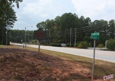
Photographed by Mike Stroud, 2011
5. US-378 & Holiday Road
Credits. This page was last revised on September 11, 2022. It was originally submitted on April 17, 2011, by Brian Scott of Anderson, South Carolina. This page has been viewed 2,436 times since then and 83 times this year. Photos: 1, 2, 3, 4. submitted on April 17, 2011, by Brian Scott of Anderson, South Carolina. 5. submitted on September 21, 2011, by Mike Stroud of Bluffton, South Carolina.
