Huron Township in Erie County, Ohio — The American Midwest (Great Lakes)
First Cedar Point Road
Photographed by Jamie Abel, April 17, 2011
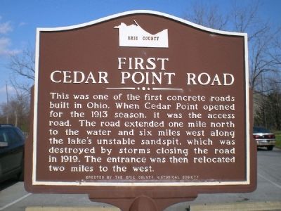
1. First Cedar Point Road Marker
This was one of the first concrete roads built in Ohio. When Cedar Point opened for the 1913 season, it was the access road. The road extended one mile north to the water and six miles west along the lake's unstable sandspit, which was destroyed by storms closing the road in 1919. The entrance was then relocated two miles to the west.
Erected by Erie County Historical Society.
Topics. This historical marker is listed in these topic lists: Entertainment • Roads & Vehicles. A significant historical year for this entry is 1913.
Location. 41° 24.498′ N, 82° 36.135′ W. Marker is near Huron, Ohio, in Erie County. It is in Huron Township. It is on Cleveland Road West (U.S. 6) 0.6 miles west of Rye Beach Road (Local Highway 122). The marker stands in a park on the north side of Old U.S. Route 6, which runs somewhat parallel to the more significant Ohio Route 2, just a couple of tenths of a mile to the south. Touch for map. Marker is at or near this postal address: 2715 Cleveland Rd W, Huron OH 44839, United States of America. Touch for directions.

Regionally, this marker is on the Lake Erie Shore and in the Western Reserve.
this page online
Other nearby markers. At least 8 other markers are within 3 miles of this marker, measured as the crow flies: Historic Roadway (here, next to this marker); Ohio Department of Natural Resources Division of Natural Areas and Preserves (within shouting distance of this marker); The Firelands (approx. 0.9 miles away); Huron’s First Inhabitants (approx. 1.8 miles away); Electric Interurban Railways / Lake Shore Electric Railway (approx. 2 miles away); World War II (approx. 2.4 miles away); The Huron Playhouse (approx. 2.4 miles away); Christ Episcopal Church (approx. 2½ miles away). Touch for a list and map of all markers in Huron.
Photographed by Jamie Abel, April 17, 2011
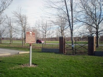
2. First Cedar Point Road Marker
The marker stands in a park on the north side of the road, with a vehicle traveling west on U.S. Route 6 in the background.
Photographed by J. J. Prats, August 8, 2019
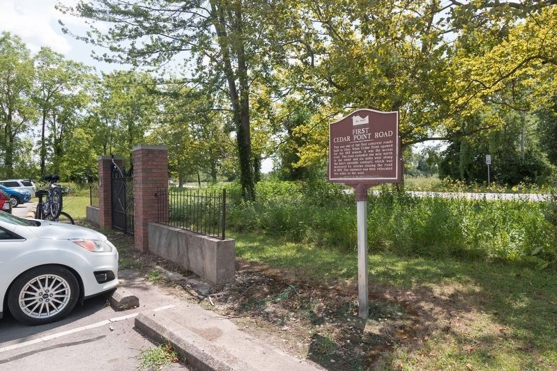
3. First Cedar Point Road Marker
The marker was relocated to a few feet away when the parking lot was enlarged.
Photographed by Jamie Abel, April 17, 2011
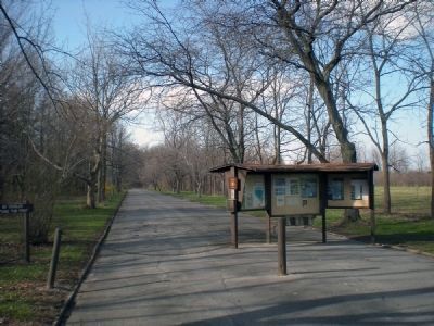
4. First Cedar Point Road
The old, defunct road to Cedar Point is now a walking path.
Credits. This page was last revised on August 19, 2026. It was originally submitted on April 18, 2011, by Jamie Abel of Westerville, Ohio. This page has been viewed 1,953 times since then and 142 times this year. Last updated on August 18, 2026, by Erie County Historical Society of Sandusky, Ohio. Photos: 1, 2. submitted on April 18, 2011, by Jamie Abel of Westerville, Ohio. 3. submitted on November 9, 2019, by J. J. Prats of Powell, Ohio. 4. submitted on April 18, 2011, by Jamie Abel of Westerville, Ohio. • Devry Becker Jones was the editor who published this page.
