Falls Village in Canaan in Litchfield County, Connecticut — The American Northeast (New England)
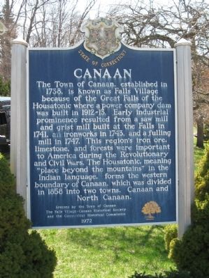
Canaan
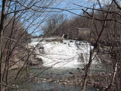
The Town of Canaan, established in 1738, is known as Falls Village because of the Great Falls of the Housatonic where a power company dam was built in 1912-13. Early industrial prominence resulted from a saw mill and grist mill built at the Falls in 1741, an iron works in 1743, and a fulling mill in 1747. This region's iron ore, limestone, and foretst were important to America during the Revolutionary and Civil Wars. The Housatonic, meaning "place beyond the mountains" in the Indian language, forms the western boundary of Canaan, which was divided in 1858 into two towns, Canaan and North Canaan.
Erected 1972 by the Town of Canaan, The Falls Village – Canaan Historical Society, the Connecticut Historical Commission.
Topics. This historical marker is listed in these topic lists: Colonial Era • Settlements & Settlers. A significant historical year for this entry is 1738.
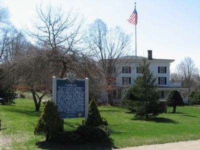
Location. 41° 57.308′ N, 73° 21.876′ W. Marker is in Canaan, Connecticut, in Litchfield County. It is in Falls Village. Marker is at the intersection of Main Street and Railroad Street, on the left when traveling west on Main Street. Touch for map. Marker is at or near this postal address: 107 Main Street, Canaan CT 06018, United States of America. Touch for directions.
Other nearby markers. At least 8 other markers are within 4 miles of this marker, measured as the crow flies. Falls Village Veterans Monument (a few steps from this marker); First Forge (approx. 2 miles away); Barnum & Richardson Foundry (approx. 2 miles away); Nation's First Public Library (approx. 3˝ miles away); Salisbury Academy (approx. 3˝ miles away); Salisbury (approx. 3˝ miles away); The Old Burying Ground (approx. 3˝ miles away); Salisbury Veterans Monument (approx. 3˝ miles away).
Regarding Canaan. Once there was a dream that Falls Village would become an industrial mecca. It would be fueled with an abundance of hydropower thanks to miles of stone canals running along the Housatonic River at the Great Falls. Those canals (along with much of Falls Village) were built up over the course of several years. In 1851, the canals finally opened. The crowds cheered, the water flowed, and everything leaked .....
.....Thanks to that dream and the fact that it died, Falls Village lives on - much as it was in 1851.
(from the Town of Canaan web page)
Also see . . .
1. Town of Canaan. (Submitted on April 20, 2011, by Michael Herrick of Southbury, Connecticut.)
2. Canaan, Connecticut on Wikipedia. (Submitted on April 20, 2011, by Michael Herrick of Southbury, Connecticut.)
Credits. This page was last revised on December 12, 2023. It was originally submitted on April 20, 2011, by Michael Herrick of Southbury, Connecticut. This page has been viewed 636 times since then and 26 times this year. Photos: 1, 2, 3. submitted on April 20, 2011, by Michael Herrick of Southbury, Connecticut.


