Otsego in Wood County, Ohio — The American Midwest (Great Lakes)
The First Presbyterian Mission in the Maumee Valley
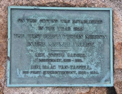
Inscription.
In the year 1822
The first Presbyterian Mission
In the Maumee Valley
—————
Rev. Joseph Badger,
Missionary, 1805 - 1812.
Rev. Isaac Van Tassell,
Its first superintendent, 1822 - 1834.
Topics. This historical marker is listed in these topic lists: Charity & Public Work • Churches & Religion • Native Americans. A significant historical year for this entry is 1822.
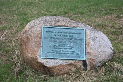
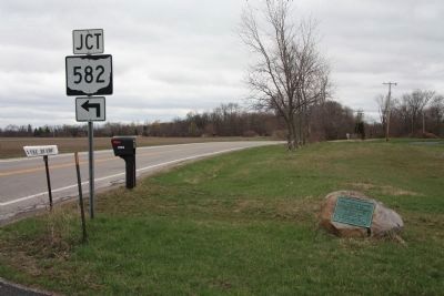
Location. 41° 27.868′ N, 83° 44.67′ W. Marker is in Otsego, Ohio, in Wood County. Marker is on West River Road (Ohio Route 65) north of Middleton Pike (Ohio Route 582), on the right when traveling south. This historical marker is affixed to a large stone boulder that is located on the river side of the road, just south of a driveway entrance that services two different residences. Touch for map. Marker is at or near this postal address: 17950 West River Road, Bowling Green OH 43402, United States of America. Touch for directions.
Other nearby markers. At least 8 other markers are within 2 miles of this marker, measured as the crow flies. Browning Masonic Community (approx. 0.8 miles away); The Towpath Trail (approx. 0.9 miles away); Roche de Bout (approx. 1.6 miles away); a different marker also named The Towpath Trail (approx. 1.6 miles away); Fort Deposit / Roche de Bout (approx. 1.6 miles away); Bowling Green Fault (approx. 1.8 miles away); Ohio Electric Railroad Bridge / Roche De Bout, Roche De Boeuf (approx. 1.8 miles away); Haskins (approx. 2 miles away).
Credits. This page was last revised on June 16, 2016. It was originally submitted on April 28, 2011, by Dale K. Benington of Toledo, Ohio. This page has been viewed 742 times since then and 29 times this year. Photos: 1, 2, 3. submitted on April 30, 2011, by Dale K. Benington of Toledo, Ohio.


