Elfrida in Cochise County, Arizona — The American Mountains (Southwest)
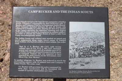
Camp Rucker and the Indian Scouts
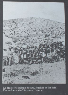
The Indian Scouts and enlisted men worked on guard and escort assignments along major travel routes, or tracked down Indians who had not settled on reservations. One order read:
“2nd Lt. J.A. Rucker, 6th CAV, with twenty enlisted men of Cos. H & L, 6th CAV, mounted, armed and equipped, and all available men of Co. C Indian Scouts will proceed in search of the party of renegade Indians who are reported to have attacked the mail courier on the 3rd instant, near Silver City, New Mexico.”
In another telegram, Lt. Rucker was ordered to search the surrounding country with 16 enlisted men and Company C, Indian Scouts. The order read:
“Lt. Rucker will provision his entire command for forty days. Cavalrymen will be furnished 100 rounds of carbine ammunition per man.”
Erected by United States Forest Service.
Topics. This historical marker is listed in these topic lists: Forts and Castles • Wars, US Indian.
Location. 31° 45.256′ N, 109° 21.512′ W. Marker is in Elfrida, Arizona, in Cochise County. Marker is on North Tex Canyon Road near East Rucker Canyon Road. Touch for map. Marker is in this post office area: Elfrida AZ 85610, United States of America. Touch for directions.
Other nearby markers. At least 6 other markers are within 9 miles of this marker, measured as the crow flies. Camp John A. Rucker A Military Outpost (a few steps from this marker); How Camp Rucker received its Name (a few steps from this marker); Old Camp Rucker Ranch (within shouting distance of this marker); Camp Rucker Bakery and Commissary (within shouting distance of this marker); Camp Rucker Timeline (within shouting distance of this marker); John Ringo (approx. 8½ miles away).
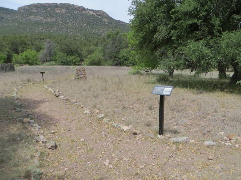
More about this marker. The U.S. Army set up a supply depot in 1878 for Indian scouts who patrolled the region on the lookout for hostile Apache. Originally named Camp Supply, it later became Camp Rucker to honor Lt. Rucker who drowned while trying to save another man during a flash flood. The camp saw use until Geronimo's surrender in 1886, when it became part of a ranch. You can visit this site and walk an interpretive
trail past the adobe bakery, still in good condition, and the large ruin of the commissary with its stone cellar. From the junction of Forest Roads 74 and 74E near Camp Rucker Group Use Area, head east 0.7 mile on Forest Road 74 and look for a gate in the fence on the left; park outside the gate, walk in about 0.1 mile, then turn left past the barn to the site.
Source: The Arizona Handbook
Credits. This page was last revised on June 6, 2020. It was originally submitted on May 1, 2011, by James Nuti of Bisbee, Arizona. This page has been viewed 1,076 times since then and 47 times this year. Photos: 1, 2. submitted on April 30, 2011, by James Nuti of Bisbee, Arizona. 3. submitted on June 6, 2020, by Bill Kirchner of Tucson, Arizona. • Syd Whittle was the editor who published this page.


