
Parker in Bay County, Florida — The American South (South Atlantic)
Site of Loftin's Ferry
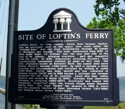
Photographed by Paul F, April 27, 2011
1. Site of Loftin's Ferry Marker
East side of two-sided marker.
this page online
Erected 2001 by City of Parker and the Florida Department of State. (Marker Number F-459.)
Topics. This historical marker is listed in these topic lists: Settlements & Settlers • Waterways & Vessels. A significant historical year for this entry is 1836.
Location. 30° 7.692′ N, 85° 36.648′ W. Marker is in Parker, Florida, in Bay County. It is on Pitts Avenue 0.1 miles south of Aster Street, on the right when traveling south. Marker is located at the bend in the road where Pitts Avenue turns east. Touch for map. Marker is in this post office area: Panama City FL 32404, United States of America. Touch for directions.

Regionally, this marker is on the Florida Panhandle. It is also in the American South, specifically in the Deep South, and on the Gulf Coast. Globally, it is in the North Atlantic Region, North America, a Gulf of Mexico state, the Western Hemisphere, the Western World, and the Anglosphere. Historically, it finds itself in what was once New Spain, the territory of the Mississippian Culture,
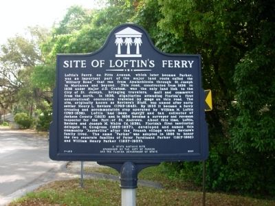
Photographed by Paul F, April 27, 2011
2. Site of Loftin's Ferry Marker
West side of two-sided marker.
Other nearby markers. At least 8 other markers are within 2 miles of this marker, measured as the crow flies: Holmes/Anderson House (approx. 1.8 miles away); Bay Harbor/Andrews Family House (approx. 2 miles away); Stephenson/Turner House (approx. 2 miles away); W.H. & Idumea Gray Marshall Home (approx. 2.1 miles away); The C.M. “Kid” Harris House (approx. 2.1 miles away); Scott/Yerby House (approx. 2.1 miles away); The Buran/Lumber Company House (approx. 2.1 miles away); The Doctor’s House (approx. 2.1 miles away).
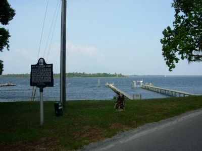
Photographed by Paul F, April 27, 2011
3. Site of Loftin's Ferry Marker
Looking out to the bay.
Credits. This page was last revised on June 16, 2016. It was originally submitted on May 2, 2011, by Paul Fehrenbach of Richfield, Wisconsin. This page has been viewed 2,249 times since then and 66 times this year. Photos: 1, 2, 3. submitted on May 2, 2011, by Paul Fehrenbach of Richfield, Wisconsin. • Bernard Fisher was the editor who published this page.
