Flat Top in Mercer County, West Virginia — The American South (Appalachia)
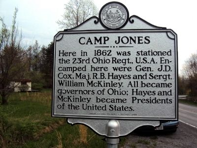
Camp Jones
Here in 1862 was stationed the 23rd Ohio Regt., U.S.A. Encamped here were Gen. J.D. Cox, Maj. R.B. Hayes and Sergt. William McKinley. All became governors of Ohio; Hayes and McKinley became Presidents of the United States.
Erected 2010 by West Virginia Archives and History.
Topics and series. This historical marker is listed in these topic lists: Government & Politics • War, US Civil. In addition, it is included in the Former U.S. Presidents: #25 William McKinley, and the West Virginia Archives and History series lists. A significant historical year for this entry is 1862.
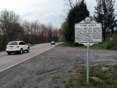
Location. 37° 39.033′ N, 81° 7.55′ W. Marker is in Flat Top, West Virginia, in Mercer County. Marker is at the intersection of U.S. 19 and Toad Level Road, on the right when traveling north on U.S. 19. Touch for map. Marker is in this post office area: Flat Top WV 25841, United States of America. Touch for directions.
Other nearby markers. At least 8 other markers are within 9 miles of this marker, measured as the crow flies. Ghent Explosion Memorial (approx. 1.9 miles away); Shady Spring (approx. 4.3 miles away); Glade Creek Reservoir (approx. 4.6 miles away); Grandview Park (approx. 5˝ miles away); Raleigh County / Summers County (approx. 6.8 miles away); Big Beaver Creek Ancient Fortification (approx. 7.1 miles away); Korean War Memorial (approx. 8 miles away); "The Most Modern Club": Black Knight (approx. 8.2 miles away).
Also see . . .
1. Biography of Rutherford B. Hayes. From the Rutherford B. Hayes Presidential Center. (Submitted on May 5, 2011, by Jamie Abel of Westerville, Ohio.)
2. William McKinley. From the William McKinley Presidential Center. (Submitted on May 6, 2011, by Jamie Abel of Westerville, Ohio.)
3. Jacob Dolson Cox. Wikipedia article. (Submitted on May 6, 2011, by Jamie Abel of Westerville, Ohio.)
Credits. This page was last revised on August 2, 2022. It was originally submitted on May 5, 2011, by Jamie Abel of Westerville, Ohio. This page has been viewed 1,175 times since then and 29 times this year. Photos: 1, 2. submitted on May 5, 2011, by Jamie Abel of Westerville, Ohio. • Craig Swain was the editor who published this page.

