Cohoes in Albany County, New York — The American Northeast (Mid-Atlantic)
The Erie Canal
Power Canal Park | Cohoes NY
Photographed by Howard C. Ohlhous, May 6, 2011
1. The Erie Canal Marker
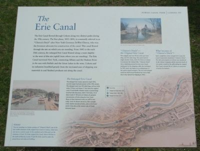
The Erie Canal flowed through Cohoes along two distinct paths during the 19th century. The first phase, 1825-1841, is commonly referred to as "Clinton's Ditch" after New York Governor DeWitt Clinton, who was the foremost advocate for construction of the canal. This canal flowed through the site on which you are standing. From 1842 to early 20th century, the enlarged Erie Canal flowed along a route slightly to the west of this site (uphill from where you are standing). The Erie Canal traversed New York, connecting Albany and the Hudson River in the east with Buffalo and the Great Lakes in the west. Cohoes and its industries benefited greatly from the increased ease of shipping raw materials in and finished products out along the canal.
this page online
Photographed by Howard C. Ohlhous, May 6, 2011
2. The Erie Canal Marker
Erected 2004 by City of Cohes.
Topics and series. This historical marker is listed in this topic list: Waterways & Vessels. In addition, it is included in the Erie Canal series list. A significant historical month for this entry is April 1842.
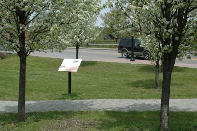
Location. 42° 46.765′ N, 73° 42.203′ W. Marker is in Cohoes, New York, in Albany County. It can be reached from North Mohawk Street, on the right when traveling south. The marker is beside the footpath at the south end of the Power Canal Park. Touch for map. Marker is in this post office area: Cohoes NY 12047, United States of America. Touch for directions.

Regionally, this marker is in Upstate New York, in the Capital District, and in the Albany Metropolitan Area. It is also in the American Northeast and in the Mid-Atlantic. Globally, it is in North
Photographed by Howard C. Ohlhous, April 7, 2011
3. The Erie Canal Marker
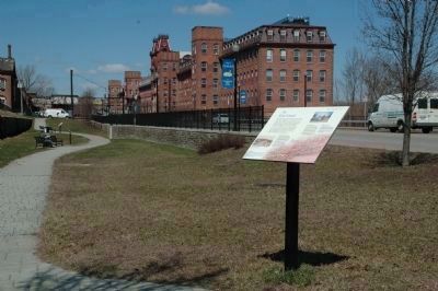
The Erie Canal Marker is in the south end of the Power Canal Park. The rest of the drained power canal can be seen beyond the marker in the background.
Other nearby markers. At least 8 other markers are within walking distance of this marker: Power Canal Park (here, next to this marker); Developing an Industrial Empire (within shouting distance of this marker); The Harmony Mills Historic District (within shouting distance of this marker); The Harmony Mills (about 300 feet away, measured in a direct line); The Cohoes Mastodont (about 400 feet away); A Company Town (about 400 feet away); Rise of the Harmony Company (approx. 0.2 miles away); Capturing the Power of Water (approx. ¼ mile away). Touch for a list and map of all markers in Cohoes.
Also see . . . Cohoes Company Power Canal System, Level 2, North Mohawk Street, Cohoes, Albany, NY HABS. Library of Congress website entry (Submitted on May 19, 2011, by Howard C. Ohlhous of Duanesburg, New York.)
Photographed by Howard C. Ohlhous
4. The Power Canal; Now & Then
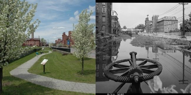
On the left the Erie Canal Marker is mounted in the bed of the former power canal. On the right is the power canal in a photo from the Historic American Building Survey from 1969. The Harmony Mill #3 is the large sructure in the upper right in both photos.
Photographed by Howard C. Ohlhous, March 16, 2011
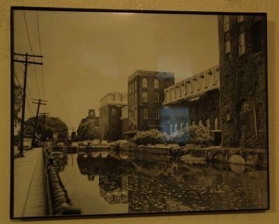
5. The Power Canal
This view of the power canal is on display in the Cohoes City Hall building.
Images of the Erie Canal at Cohoes
The Erie Canal website entry
Click for more information.
Images of the Erie Canal at Cohoes
The Erie Canal website entry
Click for more information.
Credits. This page was last revised on July 20, 2021. It was originally submitted on May 7, 2011, by Howard C. Ohlhous of Duanesburg, New York. This page has been viewed 2,472 times since then and 52 times this year. Photos: 1. submitted on May 7, 2011, by Howard C. Ohlhous of Duanesburg, New York. 2. submitted on May 8, 2011, by Howard C. Ohlhous of Duanesburg, New York. 3, 4, 5. submitted on May 19, 2011, by Howard C. Ohlhous of Duanesburg, New York. • Bill Pfingsten was the editor who published this page.
