
Oswego in Labette County, Kansas — The American Midwest (Upper Plains)
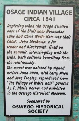
Osage Indian Village
Circa 1841
Photographed by William Fischer, Jr., December 26, 2010
1. Osage Indian Village Marker
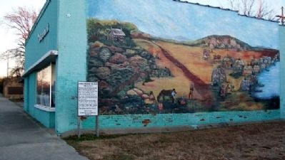
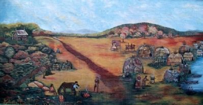
Depicting when the Osage dwelled east of the bluff near Horseshoe Lake and Chief White Hair was their Chief. John Mathews, a fur trader and blacksmith, lived on the summit, intermingling with the tribe, both cultures benefiting from the relationship.
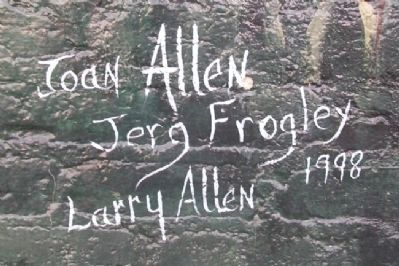
The mural was painted by signed artists Joan Allen, with Larry Allen and Jerg Frogley, reproduced from "The Village of White Hair" painted by E. Marie Horner and exhibited in the Oswego Historical Museum.
Erected by Oswego Historical Society.
Topics. This historical marker is listed in these topic lists: Exploration • Indigenous Peoples and Communities • Peace • Settlements & Settlers. A significant historical year for this entry is 1841.
Location. 37° 10.016′ N, 95° 6.502′ W. Marker is in Oswego, Kansas, in Labette County. It is on 4th Street near Commercial Street, on the right when traveling east. Touch for map. Marker is in this post office area: Oswego KS 67356, United States of America. Touch for directions.

Regionally, this marker is in Eastern Kansas. It is also in the American Midwest, in the Corn Belt, on the prairies, and on the Southern Plains. Globally, it is in North America, the Western Hemisphere, the Western World, and the Anglosphere. Historically, it finds itself in what was once New Spain and also the Louisiana Purchase.
Other nearby markers. At least 8 other markers are within 9 miles of this marker, measured as the crow flies: Sulky Plow (about 500 feet away, measured in a direct line); KATY Caboose Number 109 (about 700 feet away); The Little Town Well (approx. 0.4 miles away); John A. Mathews Park (approx. 0.4 miles away); Riverside Park (approx. 0.7 miles away); Historic Riverside Park (approx. ¾ mile away); Veterans Memorial Auditorium — Gymnasium (approx. 8.9 miles away); Parish of Sacred Heart - Chetopa
this page online
Also see . . .
1. The Osage Indians. Legends of America website entry (Submitted on May 10, 2011, by William Fischer, Jr. of Reynoldsburg, Ohio.)
2. The Osage Nation. Website homepage (Submitted on May 10, 2011, by William Fischer, Jr. of Reynoldsburg, Ohio.)
3. Osage Tribe Genealogy. Kansas Genealogy website entry (Submitted on May 10, 2011, by William Fischer, Jr. of Reynoldsburg, Ohio.)
Photographed by William Fischer, Jr., December 26, 2010
2. Osage Indian Village Mural and Marker
Photographed by William Fischer, Jr., December 26, 2010
3. Osage Indian Village Mural
Photographed by William Fischer, Jr., December 26, 2010
4. Osage Indian Village Mural Artists
Credits. This page was last revised on December 15, 2024. It was originally submitted on May 10, 2011, by William Fischer, Jr. of Reynoldsburg, Ohio. This page has been viewed 1,807 times since then and 50 times this year. Photos: 1, 2, 3, 4. submitted on May 10, 2011, by William Fischer, Jr. of Reynoldsburg, Ohio.
