Vandalia in Fayette County, Illinois — The American Midwest (Great Lakes)
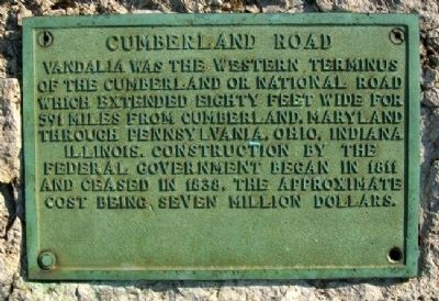
Cumberland Road
Erected by Illinois State Historical Society.
Topics and series. This historical marker is listed in these topic lists: Charity & Public Work • Communications • Exploration • Roads & Vehicles. In addition, it is included in the Illinois State Historical Society, and the The Historic National Road series lists. A significant historical year for this entry is 1811.
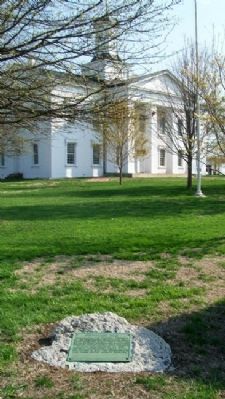
Location. 38° 57.652′ N, 89° 5.669′ W. Marker is in Vandalia, Illinois, in Fayette County. Marker is at the intersection of 4th Street and Gallatin Street, on the right when traveling north on 4th Street. Marker is near the southwest corner of the Old State Capitol grounds. Touch for map. Marker is in this post office area: Vandalia IL 62471, United States of America. Touch for directions.
Other nearby markers. At least 8 other markers are within walking distance of this marker. Madonna of the Trail (here, next to this marker); First Protest Against Slavery (a few steps from this marker); The Charters Hotel (within shouting distance of this marker); Flack's Hotel (within shouting distance of this marker); Second State Capitol (within shouting distance of this marker); First Elective Office (within shouting distance of this marker); Third State Capitol (within shouting distance of this marker); Lincoln and the "Long Nine" (within shouting distance of this marker). Touch for a list and map of all markers in Vandalia.
Also see . . .
1. National Road Association of Illinois. Association website homepage (Submitted on May 12, 2011, by William Fischer, Jr. of Scranton, Pennsylvania.)
2. Route 40 Mile by Mile Thru Illinois. Route 40 website entry (Submitted on May 12, 2011, by William Fischer, Jr. of Scranton, Pennsylvania.)
Credits. This page was last revised on May 28, 2021. It was originally submitted on May 12, 2011, by William Fischer, Jr. of Scranton, Pennsylvania. This page has been viewed 995 times since then and 38 times this year. Photos: 1, 2. submitted on May 12, 2011, by William Fischer, Jr. of Scranton, Pennsylvania.

