Near Bedford in Bedford County, Virginia — The American South (Mid-Atlantic)
Hunter's Bivouac
Photographed by Bernard Fisher, May 29, 2011
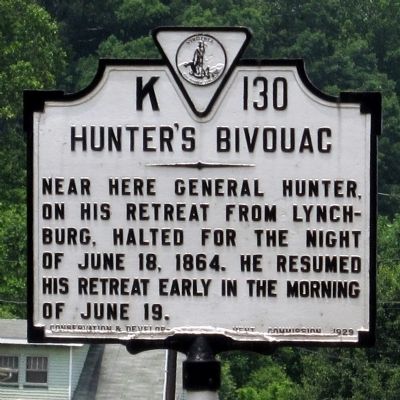
1. Hunter's Bivouac Marker
Near here General Hunter, on his retreat from Lynchburg, halted for the night of June 18, 1864. He resumed his retreat early in the morning of June 19.
Erected 1929 by Conservation & Development Commission. (Marker Number K-130.)
Topics and series. This historical marker is listed in this topic list: War, US Civil. In addition, it is included in the Virginia Department of Historic Resources (DHR) series list. A significant historical date for this entry is June 18, 1834.
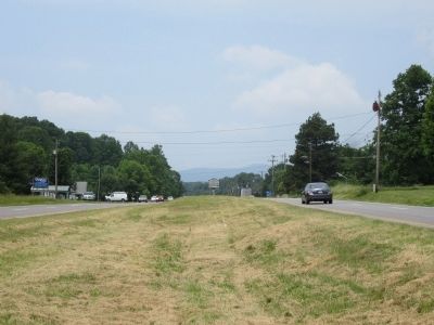
Location. 37° 20.744′ N, 79° 34.248′ W. Marker is near Bedford, Virginia, in Bedford County. It is on West Lynchburg Salem Turnpike (U.S. 460) 0.3 miles west of Patterson Mill Road (Virginia Route 680), in the median. Touch for map. Marker is at or near this postal address: 1785 W Lynchburg Salem Tpke, Bedford VA 24523, United States of America. Touch for directions.

Regionally, this marker is in Southwest Virginia. It is also in the American South and specifically in the Upper South. Globally, it is in North America, the Western Hemisphere, the Western World, and the Anglosphere. Historically, it finds itself in what was once the territory of the
this page online
Other nearby markers. At least 8 other markers are within 3 miles of this marker, measured as the crow flies: Annie J. Bronson Veterans Memorial Walk (approx. 2 miles away); The Elks National Home (approx. 2.1 miles away); W.E. Steven’s Family Victory Garden (approx. 2.1 miles away); Bobbie and Peggy Quonset Hut (approx. 2.1 miles away); Bobbie G. Johnson Pavilion (approx. 2.1 miles away); Franklin Delano Roosevelt (approx. 2.1 miles away); In Homage (approx. 2.2 miles away); The Bedford Boys (approx. 2.2 miles away). Touch for a list and map of all markers in Bedford.
Also see . . . The Lynchburg Campaign (Hunter's Raid). Essential Civil War Curriculum (Submitted on March 24, 2022, by Larry Gertner of New York, New York.)
Photographed by Bernard Fisher, May 29, 2011
2. US Rt 460 (facing west)
Credits. This page was last revised on March 24, 2022. It was originally submitted on May 30, 2011, by Bernard Fisher of Richmond, Virginia. This page has been viewed 2,157 times since then and 129 times this year. Photos: 1, 2. submitted on May 30, 2011, by Bernard Fisher of Richmond, Virginia.
