
Forest in Bedford County, Virginia — The American South (Mid-Atlantic)
St. Stephen's Church
Photographed by Bernard Fisher, May 29, 2011
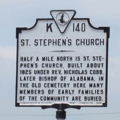
1. St. Stephen's Church Marker
Half a mile north is St. Stephen's Church, built about 1825 under Rev. Nicholas Cobb, later Bishop of Alabama. In the old cemetery here many members of early families of the community are buried.
Erected 1929 by Conservation & Development Commission. (Marker Number K-140.)
Topics and series. This historical marker is listed in these topic lists: Cemeteries & Burial Sites • Religion & Religious Structures. In addition, it is included in the Virginia Department of Historic Resources (DHR) series list. A significant historical year for this entry is 1825.
Location. 37° 22.141′ N, 79° 17.986′ W. Marker is in Forest, Virginia, in Bedford County. It is on Forest Road (U.S. 221) east of Venture Drive, on the right when traveling west. Touch for map. Marker is at or near this postal address: 14595 Forest Rd, Forest VA 24551, United States of America. Touch for directions.

Regionally, this marker is in Southwest Virginia. It is also in the American South and specifically in the Upper South. Globally, it is in North America, the Western Hemisphere, the Western World, and the Anglosphere. Historically, it finds
this page online
Other nearby markers. At least 8 other markers are within 3 miles of this marker, measured as the crow flies: Poplar Forest (approx. 2.1 miles away); Transforming a Plantation into a Private Retreat, 1806—1826 (approx. 2.4 miles away); Mounds Made of Ideas and Sweat (approx. 2.4 miles away); Poplar Forest Planting Memorandum 1812 (approx. 2.4 miles away); "A Culture Productive of Infinite Wretchedness” (approx. 2.4 miles away); Crafting a Masterpiece, Longing for Home (approx. 2.4 miles away); “I have this summer built a wing of offices...” (approx. 2½ miles away); Plantation Worker Housing (approx. 2½ miles away). Touch for a list and map of all markers in Forest.
Other markers no longer nearby. Commemorating Lewis and Clark (was approx. 2.4 miles away but has been replaced with another marker now near it); Why build the mounds? (was approx. 2.4 miles away but has been replaced with another marker now near it); How was the landscape partitioned?
via Virginia Department of Historic Resources, unknown
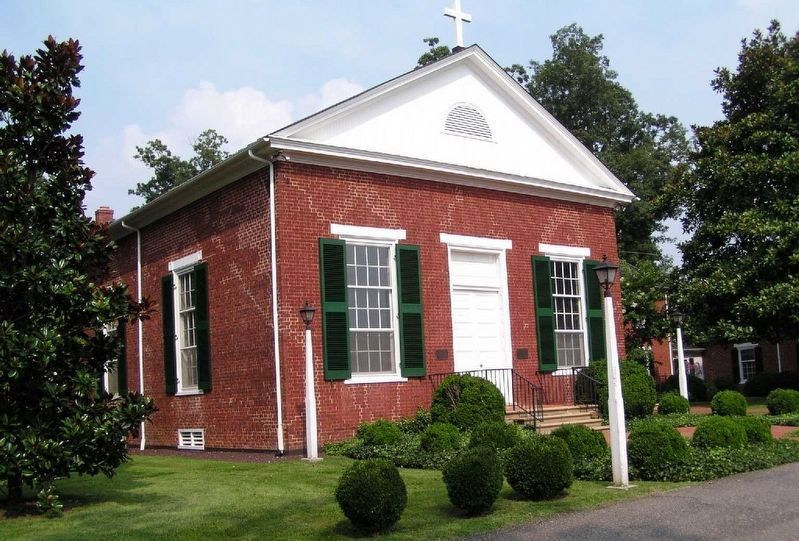
2. St. Stephen's Episcopal Church
Also see . . .
1. Saint Stephen's Episcopal Church. Church website entry (Submitted on May 31, 2011, by Bernard Fisher of Richmond, Virginia.)
2. Saint Stephen's Episcopal Church. Virginia Department of Historic Resources website entry (Submitted on May 31, 2011, by Bernard Fisher of Richmond, Virginia.)
Photographed by Bernard Fisher, May 29, 2011
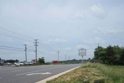
3. US Rt 221 (facing west)
Credits. This page was last revised on April 23, 2026. It was originally submitted on May 31, 2011, by Bernard Fisher of Richmond, Virginia. This page has been viewed 857 times since then and 28 times this year. Photos: 1. submitted on May 31, 2011, by Bernard Fisher of Richmond, Virginia. 2. submitted on March 30, 2022, by Larry Gertner of New York, New York. 3. submitted on May 31, 2011, by Bernard Fisher of Richmond, Virginia.
