Savannah in Andrew County, Missouri — The American Midwest (Upper Plains)
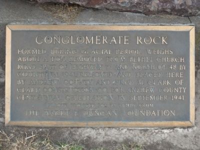
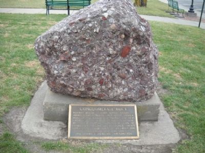
Conglomerate Rock
Erected 1941 by The Harry F. Duncan Foundation.
Topics. This historical marker is listed in this topic list: Natural Features. A significant historical month for this entry is September 1941.
Location. 39° 56.466′ N, 94° 49.8′ W. Marker is in Savannah, Missouri, in Andrew County. Marker is on Court St. just north of S. 5th Street, on the right when traveling north. Touch for map. Marker is at or near this postal address: 411 Court St, Savannah MO 64485, United States of America. Touch for directions.
Other nearby markers. At least 8 other markers are within 12 miles of this marker, measured as the crow flies. First Christian Church (within shouting distance of this marker); Andrew County (about 300 feet away, measured in a direct line); Christian Church in Savannah, Missouri (about 400 feet away); Lovers Lane, Saint Jo (approx. 10.3 miles away); "Espyd. a wolf" (approx. 10.8 miles away in Kansas); The Lewis and Clark Expedition (approx. 11.3 miles away); William Mitchelhill (approx. 11.4 miles away); David Johnson Heaton (approx. 11.4 miles away). Touch for a list and map of all markers in Savannah.
Also see . . . Andrew County Website. (Submitted on June 1, 2011, by Thomas Onions of Olathe, Kansas.)
Credits. This page was last revised on June 16, 2016. It was originally submitted on June 1, 2011, by Thomas Onions of Olathe, Kansas. This page has been viewed 1,053 times since then and 11 times this year. Photos: 1, 2. submitted on June 1, 2011, by Thomas Onions of Olathe, Kansas. • Bill Pfingsten was the editor who published this page.

