Near Newcastle in Weston County, Wyoming — The American West (Mountains)
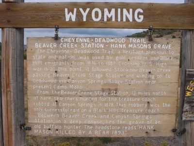
Cheyenne – Deadwood Trail
Beaver Creek Station – Hank Masons Grave
The Cheyenne-Deadwood Trail, a heritage precious to state and nation, was used by gold seekers and Black Hills emigrants from 1876 to 1887. Crossing U. S. Highway 16 at this point, it followed Stockade Beaver Creek passing Beaver Creek Stage Station and winding on to Deadwood via Canyon Springs Stage Station near present Camp Mallo.
From the Beaver Creek Station, 13 miles north of here, searchers hunted for the treasure coach robbed at Canyon Springs in 1878. This robbery was the only successful raid on a Black Hills treasure coach.
Between Beaver Creek and Canyon Springs Station, in a deep canyon, lies the grave of an old buffalo hunter. The headstone reads: "Hank Mason killed by a bear 1893".
Topics. This historical marker is listed in these topic lists: Cemeteries & Burial Sites • Roads & Vehicles. A significant historical year for this entry is 1876.
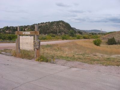
Location. 43° 48.814′ N, 104° 6.508′ W. Marker is near Newcastle, Wyoming, in Weston County. Marker is at the intersection of U.S. 16 and Beaver Creek Road, on the left when traveling east on U.S. 16. Marker is 3.7 mi E of US-85. Touch for map. Marker is in this post office area: Newcastle WY 82701, United States of America. Touch for directions.
Other nearby markers. At least 8 other markers are within 8 miles of this marker, measured as the crow flies. Camp Jenney (approx. ¾ mile away); The Jenney Stockade (approx. ¾ mile away); Site of Field City (approx. one mile away); Accidental Oil Well (approx. 1.7 miles away); The Trains Power Newcastle (approx. 5.6 miles away); Cambria Powers the Trains (approx. 5.6 miles away); Hanging of Diamond L. Slim Clifton (approx. 5.6 miles away); Cambria (approx. 8 miles away). Touch for a list and map of all markers in Newcastle.
Also see . . .
1. Cheyenne-Black Hills Stage Route Historic District. Wyoming State Historic Preservation Office website entry (Submitted on March 6, 2024, by Larry Gertner of New York, New York.)
2. Henry “Hank” Mason Jr. Find A Grave website entry (Submitted on March 6, 2024, by Larry Gertner of New York, New York.)
Credits. This page was last revised on March 6, 2024. It was originally submitted on December 19, 2007, by Keith L of Wisconsin Rapids, Wisconsin. This page has been viewed 4,294 times since then and 56 times this year. Photos: 1, 2. submitted on December 19, 2007, by Keith L of Wisconsin Rapids, Wisconsin. • J. J. Prats was the editor who published this page.

